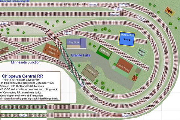
Mike, this zoom-in of the plan with grade and elevation labels may be helpful. I left the grade displayed on each track section.
For this experiment, I raised the elevated section to 8" by continuing the grade across the bridge over Granite Falls up to the turnout marked as 8". So the entire Clara City loop is level at 8". Raising the elevation to 8" did not increase the grades elsewhere, so this seems doable. I double-checked, and it is common prototype practice to continue grades across bridges and trestles.
Because the grade changes over the turnout at the very top-right, I left the two turnouts level at 3" in height, and the grades either climb or drop from those turnouts. The top-right turnout is 13 1/8' long, and if including the 1-3/8 fitters, results in a level across that turnout of about 14.5".


