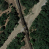
This story just popped up on Google News for me and caught my eye. Thankfully, no oil. For kicks and grins I decided to locate the area on Google maps. When I switched to earth view, I was taken aback at what I saw. The tracks over the river were not straight. To my eye, they looked like a flex track that someone tried to make straight after being used as a curve, badly. I don't know how old the satellite image is, but usually Google's are a year or less. I'm sure the torrential rains contributed to this accident as well. I'm very unfamiliar with how real railroads work, but after looking at a lot of track on Google, I have never seen anything that looked this bad. I don't wish to play detective but I am curious if this is more common than I would believe.
Google Co-ordinates: 38.356379, -121.345010


