
SW Chief to Flagstaff, AZ. Stay overnite at double tree, rent car and drive to S rim of GC. then the north rim ,then to horseshoe. then to Hoover Dam.Then off to Zion NP, then to Bryce Canyon, Then to The Arches (Moab), Then to the 4 corners. & lastly to Gallup, NM to leave off the car and catch the SW Chief back to Chicago & then on to Boston. We dropped the trip to LA, too much after the Parks. The reason we are picking up the train in Gallup is because it arrives in Flagstaff at 4:38 in the morning, & it arrives in Gallup at 8:12 AM. We are leaving early May.  July and August are too Hot and too crowded. Sounds good???  I have already made the Amtrak reservations, & all the hotel reservations.

Last edited by eddie g
Original Post

Replies sorted oldest to newest

Eddie,

I wish that I could take a trip like yours.  You are going to have a fabulous time.  Zion is my favorite park of the bunch.

Hoover Dam to LA is a long and boring driving.  The last few miles into LA proper are usually a stop and go traffic jam unless you are arriving early Sunday morning.  I hope that you have someone traveling with you to help with the driving and navigation.

NH Joe


Sounds better, but wish your friend lived in San Bernardino or other eastern suburb. Always surprised when people like Zion, but my visits have always been quick drive throughs. There are miles of red rock country to explore, or view in passing, and other parks.  Zane Grey wrote many westerns describing it. He didn't exaggerate.

Zion and Bryce are my two favorite national parks.
I wasn't so thrilled by Arches.

When we went to the Hoover Dam, there were two choices for the tours. I recommend the deluxe one, the extra stuff you get to see is interesting.

Last edited by C W Burfle

Much better plan Eddie and no backtracking. Southern Utah is spectacular. You could spend a week there alone and not see it all. From Bryce to Arches will likely take you along UT 12. This is one of the most scenic drives in the country taking you over Escalante Staircase. You won't forget it. Another tip, pick up a copy of "Roadfood" by the Stearns. It filled with eateries only the locals know about and many tucked away off the beaten path especially if you prefer to avoid the big chains.

Pete

Last edited by Norton

Scrapiron is right on:  MONUMENT VALLEY is my favorite of all except the Grand Canyon.  It is on the Arizona/Utah border northeast of the Grand Canyon.  You have seen the red-rock "tree stumps" a hundred times in John Wayne movies, BACK TO THE FUTURE 3 (Indians on horseback at the drive-in theatre), FORREST GUMP (background scene when he finally stops running across the USA) and dozens of movies and TV shows.  It is a Navajo Tribal Park, dusty, but a sublime place in the world.  The best place to buy native Indian jewelry in the SW USA is in the plywood and 2x4 huts on the road into the Park.  The huts are not impressive but most sellers of Indian jewelry everywhere buy their inventory right there in those simple little huts.

Ride the open truck with roof (like the Silverton gondolas with roof) into the park.  The dust will roll but it is outstanding scenery and narration.


Rich has it right.  Note that Bryce Canyon and the north Rim of the Grand Canyon are over 9,000 ft.  Even late April the North Rim of the Grand Canyon may be closed.  Our early  April trip to the Great southwest saw snow.   

Past May, through late September, hiking at the Grand Canyon can be restricted to night time/early morning (head light hiking), do to the heat.  The southwest heat is a big concern.  Best wishes with your vacation.   

Bryce Canyon  early April.

South Rim of the Grand Canyon a few days later.

Our hike to the bottom, South Kaibab Trail.

My Sweetheart hiking buddy. Snow went away by the time we reach Cedar Ridge.

The great south west has always been a true adventure.  

2014  South Rim photos. Mid September

Early morning sunrise at Cedar Ridge, South Kiabab trail, after headlight hiking for several hrs. It was getting hot quickly, as soon as the sun was up, we were looking for shade. 

Hot by 9:00 AM.


Last edited by Mike CT

If I read things right, this appears to be the route you'd take if you follow the Google Maps suggestions. There will be backtracking from the Zion area to Hoover Dam and back. It's a 3-hr trip each way and that assume the North Rim will be open when you go. Otherwise, you'd just go from the South Rim over to Hoover Dam and up to Zion. Having just returned from a trip to LA where we visited Port Hueneme, Hollywood, Getty Villas and the Queen Mary, I can attest to how bad the traffic is and it's not even spring/summer yet. The 101 and 405 were horrendous both coming into town and going out at all times of the day. Fortunately, we didn't encounter any accidents, but it was stop and go all lanes for good periods of time. Traffic doesn't bother me, but it was still very frustrating and worse than any previous visit, the latest just 2 years ago.

The North Rim is CLOSED FOR THE WINTER

The North Rim will reopen on May 15, 2017
https://www.nps.gov/grca/planyourvisit/conditions.htm


Capture


Attachments

Images (1)
  • Capture

We had done an overnight stay a couple of time, Boulder City, NV, which is the town closest to the Hoover Dam.  I had posted this before.   There is a walking trail that was the ROA for the construction railroad that transported all the equipment and concrete to the Hoover Dam Site.   There are five tunnels as part of this trail.  Trail can be accessed behind the Hacienda Hotel and Casino or the Lake Mead Recreational area.   Again enjoy, your vacation.

Railroad/Rail Trail at the Hoover Dam.   Enjoy the slideshow. 

Looking for great pictures when you get back Eddie G.  Be safe, take care, and have fun.  Mike CT.


Last edited by Mike CT

Dave, Doubledaz, makes a good point about doubling back. If his route is close to what you have planned you will be doing a lot of it. 

IMO the Grand Canyon should be on everyones bucket list. But once you see it I am not sure its worth spending a lot of time there unless you plan to hike the trails. While views from the south and north rims are different going to both sides on the same trip will take time from seeing the many other attractions in the area.

If you want to avoid backtracking you could enter the south rim from the east entrance off 89. Then exit from the south gate down to Williams. Stay on old RT66 to Kingman. This will take you though some of the old towns and you avoid I-40 with its heavy semi traffic. Then up to the dam and up to Zion. Save the north rim for another trip.

After Bryce there are other scenic spots in southern  Utah you can drive through on your way to Moab and Arches.

RT 12 runs through Escalante, after Torrey take RT24 east through Capitol Reef to Hanksville. Stop for gas at the store built into the mountain. Then take either 24 north to I-70 and stop in Goblin Valley state park.

Or for a more scenic drive take Rt 95 south which takes you through Glen Canyon and by Natural Bridges parks. Then at 191 North to Arches. 

Utah is more than just a few high points. The whole southern part of the state and surrounding area is a feast for the eyes.

Pete

Last edited by Norton

I wasn't really making a point about backtracking, just stating that there will be some if you go to Hoover after the North Rim, I believe someone said there wasn't any. I was also pointing out that the North Rim may be closed based on your timetable, so you need to adjust the route if that turns out to be the case. I also would not go out of my way on the same trip to do both the North and South rims. Many of us who visit the canyon frequently simply prefer the North Rim because it is less crowded and does get one closer to some of the formations. IMHO, the South Rim is a must, the North Rim is nice extra if you have the time, etc. Not saying don't go there if you can, but don't expect the "wow" factor to be as great. If you miss the South Rim, you've really missed the canyon. If you miss the North Rim, you've basically just missed a different view.

I will add that there is a Coral Pink Sand Dunes State Park near Zion that is worth a stop if the North Rim is closed ad you have more time in the Zion area.

Eddie,

I turned off my computer early last night, so I didn't see your post and email until this morning. I'll reply here and also to your email.

I just reviewed the first post with your latest(?) route and noticed it still says you plan to go from the South Rim to the North Rim then to Horseshoe Bend and on to Hoover Dam. If you take another look at the map I posted, you will see there is only one route from the South Rim to the North Rim and it goes right past Horseshoe Bend, so you want to stop at Horseshoe Bend on the way to the North Rim, not after. As for times:

Horseshow Bend - We just visited last month. The short answer is it will take about 30 minutes to make the trek from the parking lot to/from the viewing area. The path is a bit of a climb in both directions, so you might have to rest a bit, depending on what kind of shape you're in. The path goes up to an interim viewing area (you can't see the Bend from it though) and then down to the Cliffside viewing area. My wife and sister-in-law didn't attempt the path down to the cliff because they knew they'd have too hard of a time on the way back. Exploring the cliff area to see different views and get photos will add to that time. I think we spent about an hour there and I would have spent more if my brother and his wife hadn't been with us.

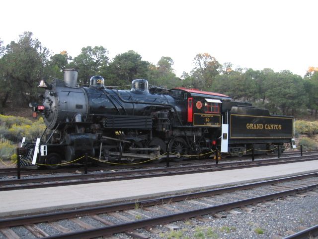
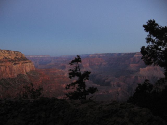
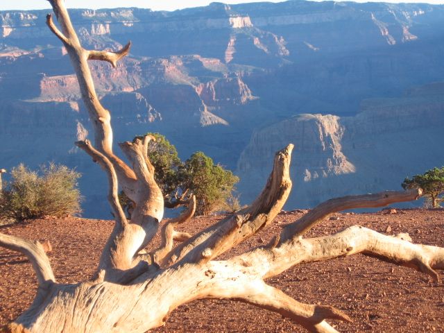
Grand Canyon South Rim - This is harder to answer because I never paid much attention to time and it's been a few years since we've been. So much depends on how many overlooks you visit and how much time you spend at each one. There are only a couple of stops between the Visitor's Center and the El Tovar area that you can drive to now, the rest you have to use their tram (bus) system. My best guess is that you'll need at least 2 hours and maybe closer to 4 hours. I believe the last time we visited, we took a little over 4 hours, but we visited every overlook, including those along Hwy 64, and the Visitor's Center.

My suggestion would be to bypass the Visitor's Center, stop at the Yavapai Point overlook and then go directly to the El Tovar Hotel area to catch the tram. Even if it's a nice day, take some water with you. If fact, you should drink a lot of water once you get to Flagstaff. Anyway, stop at each overlook along the tram route and get some ice cream or something to eat at Hermit's Rest. Then take the tram back to El Tovar, pick up you car, hit Mather's Point and the Visitor's Center on the way out, if you so desire. From there take Hwy 64 East to Hwy 89 that will take you to Horseshoe Bend. If you have time, there are more overlooks along Hwy 64. IMHO, the main thing is to catch the tram and visit those overlooks, then decide how much time you have.

It would help if you posted a more thorough itinerary that includes where you have your lodging reservations. The drive time from the Courtyard to the Visitor's Center is 1:30 hrs, from there to the Bend is 2:15 and from there to the North Rim 3:00. That's a total of 6:45 if your plans are to stay at the North Rim. Jacob's Lake would only be 1:30 from the Bend, so that cuts the total to 5:15. It's 5:00 from the North Rim to Hoover Dam and almost 8:00 if you go back to the Zion area that same day. That's why knowing where you plan to stop for the night would help figure out the best route and see how they affect the timelines.

Last edited by DoubleDAZ

Note that , not having been there, Horseshoe Bend, is accessed from the Glen Canyon dam area.  I could  be wrong. The second large dam on the Colorado River, East of the Grand Canyon. Glen Canyon Dam controls the Colorado River water flow through the G. C. National Park.   Hoover Dam is West of the Grand Canyon.  Canyon is oriented, primarily. east/west.   There are beautiful pictures of Horseshoe Bend on the internet.   Most noted area as you travel from the South Rim to the North Rim is the Painted Desert.  Enjoy the ride.   Jacobs Lake has over night accommodation, book early.  Jacobs lake to the north Rim is 40 miles. Use caution driving the road from Jacobs Lake to the North Rim, especially at night, there are a lot of animals.   There are other private vendors for an over night stay near the park. North Rim National Park accommodations, a little tougher to get.  We usually tented either at Jacobs Lake or the North Rim.

Mike CT.

Last edited by Mike CT
eddie g posted:

I've decided to just do the south rim & horseshoe bend & then heat to hoover dam. Then to Zion.

I think that's a good idea.

Like Mike said, Horseshoe Bend is near Page, so you're best bet is to go from Flagstaff to Horseshoe Bend, then double-back to the South Rim. Horseshoe Bend is south of Page, so you don't have to make the climb up into Page unless you want to. There is now a McDonald's, Jack-In-The-Box and Sonic at the roundabout about 2.5 miles north of the Bend if you get hungry. There is also a restaurant in the Cameron Trading Post and a Burger King at the roundabout where you catch Hwy 64 to the South Rim.

Flagstaff to the Bend is 2:00.
The Bend to the South Rim is 2:00.
The South Rim to Hoover Dam is 3:30.
Hoover Dam to Zion is 3:00.
Zion to Bryce is 1:30.
Bryce to Moab is 4:15.
Moab to Gallup is 4:15.

As for Arches, from what I saw, the roads are closed each night between 7 pm and 7 am through November for the road construction projects. There will undoubtedly be delays though depending on how many visitors there are, but all roads should be open.
https://www.nps.gov/arch/planyourvisit/conditions.htm


Just returned from our trip to the national parks. Took the lakeshore Ltd from boston to Chicago. Then took the south west chief to flagstaff , Az. rented a car and drove to the south rim of the grand canyon. Then to horsrshoe bend, then to Hoover dam, on to Zion nat. park. Then on to bryce canyon. then to Moab to the arches. Then down to the four corners, and then to Gallup, NM where we met the train back to chicago and on to Boston. we went all first class. It was a great trip. Thanks to those who helped me with it. Ed    P.S. The speed limit out there is 80 MPH. We did 85 & everyone went by us.

Last edited by eddie g
eddie g posted:

Just returned from our trip to the national parks. Took the lakeshore Ltd from boston to Chicago. Then took the south west chief to flagstaff , Az. rented a car and drove to the south rim of the grand canyon. Then to horsrshoe bend, then to Hoover dam, on to Zion nat. park. Then on to bryce canyon. then to Moab to the arches. Then down to the four corners, and then to Gallup, NM where we met the train back to chicago and on to Boston. we went all first class. It was a great trip. ..

Bravo!  And Hurrah for you, Eddie G !!! I admire your courage and adventuresome spirit. I think you may have just inspired me.

doug b posted:

We were at Hoover Dam about 20 months ago. I was amazed at how much the water level has dropped.

Doug

Here's a chart that shows 2017 water levels and compares them to previous years. As you can see, there is quite a bit of fluctuation throughout the year. Turn on all the years, especially 2012, to really see the difference over the past 5 years.

Last edited by DoubleDAZ
DoubleDAZ posted:
doug b posted:

We were at Hoover Dam about 20 months ago. I was amazed at how much the water level has dropped.

Doug

Here's a chart that shows 2017 water levels and compares them to previous years. As you can see, there is quite a bit of fluctuation throughout the year. Turn on all the years, especially 2012, to really see the difference over the past 5 years.

no chart found

Next trip: to Denver, rental car, hit all the narrow gauge sites, down to Cumbres and Toltec, ride it,  and on to Durango, up to Silverton and back on train,  then drive back up to Silverton and up three Mears roadbeds to Animas Forks, etc., back to Silverton and over Red Mountain Pass..at the top of the Pass, stop and walk north to the restoration of the mine structure at the site of Red Mountain Town where the station used to be in the "Y". Just the bare ruins of the jail are left, with the restored shaft house. Now with many stops to photo shaft house ruins on the slopes, and a possible side trip and climb through a creek to the site of the famous covered turntable, you get back on the road to Ouray after driving highly scenic cliff hanger roads.  At Ouray you can take a one lane jeep trail back to the site of the C amp Bird mine (or rent a jeep and really get into the Rockies0.  Stop for the small narrow gauge museum at Ridgway, check out the former Rio Grande Southern station and you can take a long drive back to Durango  following the route of the RGS through Telluride, Rico, and Delores, (should be a Goose displayed at Delores) back to Durango.  Or go north from Ridgway to Montrose, east to check out Black Canyon of the Gunnison Nat. Park,   Be sure to drive back up the canyon at Cimarron to check out restored cattle loading pens and especially the Rio Grande narrow gauge train suspended on a trestle in the middle of the mountain stream, where the D&RGW once entered the Black Canyon.   Then over Monarch Pass back to Denver.  With time left....north to Cheyenne and up to Yellowstone, the Grand Tetons (beautiful) and on to Glacier.  Should be able to get a train back east from Glacier (or Cheyenne).  They don't call it America the Beautiful for nuthin'.

Last edited by OGR CEO-PUBLISHER
colorado hirailer posted:

Next trip:...................

That would be a nice trip.  We've been to all except the back country roads and haven't ridden the Cumbres, though we did drive near the route to Chama and watched the train much of the way.

FWIW, unless there's a reason to go back to Denver and up to Cheyenne, I'd probably go from Ridgeway to Montrose to the Tetons, Yellowstone and Glacier. But that's because we used to live in Colorado Springs and traveled all over the area between Denver and Grand Junction.

While at Yellowstone, I'd take the time to drive over to Cody, up to Red Lodge and take the Beartooth Hwy back into the north entrance of Yellowstone. In fact, that was the only reason we went back to Yellowstone that trip. It's a mountain drive with lots of switchbacks and slow going, but the views and mountain lakes are awesome and great photo ops. We stayed at the Red Lodge Inn in Red Lodge and thoroughly enjoyed it, though there aren't many choices for dining. We ate breakfast at Prindy's Place (enjoyed the local café atmosphere), drove the Beartooth and had dinner in Cody that evening.

The Amtrak depot at Glacier is in Whitefish, a very pretty town in its own right and we'll spend more time there on our next trip to the area.

Add Reply

Post

OGR Publishing, Inc., 1310 Eastside Centre Ct, Suite 6, Mountain Home, AR 72653
800-980-OGRR (6477)
www.ogaugerr.com

×
×
×
×
Link copied to your clipboard.
×
×