
We spoke before about the Trolley Terminal at Delancy and Essex Street where the B&QT cars terminated after coming over the Williamsburg Bridge on trackways on the South Side of the Bridge. There was also Trackways on the North Side of the Bridge. These were used by cars on the Metropolitan railroad and later its successor nNew York Railways. Cars operated fro Washington Plaza on the Brooklyn side of the bridge and ran as follows.


Two north-side tracks carried Manhattan streetcars:


    Grand Street Line, 1904-1932

    Post Office Line, 1919-1932 (dowtown manhattan Prk Row area)

    Seventh Avenue-Brooklyn Line, 1911-1919

    8th Street Crosstown Line, 1904-1911

    14th Street-Williamsburg Bridge Line, 1904-1911

    Fourth Avenue and Williamsburg Bridge Line( To Grand Central), 1904-1911


This company was taken over in the 1930s by the Fifth Ave Coach Companywhich replaced its street car routes in Manhattan with Buses. You might remember the distictive double decker busses used on the 5th ave route of that company .


Some photos of this service on the Brooklyn side for your viewing.

27db9832b55f3ecae996e0e65235d6d5


5451407371_a920021cca_z


neig_2059


And of course , the distinctive double decker on 5th ave in manhattan


23bus1.span

Attachments

Images (4)
  • 27db9832b55f3ecae996e0e65235d6d5
  • 5451407371_a920021cca_z
  • neig_2059
  • 23bus1.span
Last edited by LIRR Steamer

Ben showed us some models of the IRT Worlds fair Steinways and the BMT Triplex cars at the NJ Hirailers in another post in this section. So here are a few photos of the real thing. The IRT cars, a fleet of 50 handled the worlds fair express service on the IRT Flushing Service in 1939. They remained in service on this line for 10 or so years beyond the fair until the arrival of new cars in the 1949-50 period. They then worked various IRT lines in Manhattan and Bronx and closed out the era on the Third Ave El in the Bronx. The Triplexes arrived on the BMT in the 1920s worked the routes on the Southern Division and were in service into 1964 or so.


Here is a Worlds Fair consist on the Flushing Line ay 52nd st in 1939


1939


A Triplex at Queensborough Plaza in the 1940's . The North Platforms are still in use


d types qb


We Know the D Types and the worlds Fair cars could be seen at Queensborough Plaza together in the 1939-1949 time frame but havent seen a photo. So Here is a photo from the 1964 Worlds Fair service with the Triplexes arriving at Queensborough Plaza, south platforms on the left and a r-36 Worlds Fair Blue Train on the right


img_41838

Attachments

Images (3)
  • 1939
  • d types qb
  • img_41838

Ben


Its amazing it even exits . There were only 50 of these built. The intent was to use these cars for the IRT express service to the Worlds Fair. In those days , the Flushing El was Jointly Operated in Queens with the BMT. The BMT Worlds Fair Service was provided by the Q types which the BMT rebuilt from open platform BU cars, known as gate cars. Both the IRT Worlds fair Steinway cars and the Qs worked this line through the 2 years of the Worlds Fair and to 1949 when the joint service was ended. Interestingly.

Both cars went to work on the Third Ave El .  The Q cars went over about 1949-50 running the Manhattan express service.   When the Third Ave El was cut back to the Bronx only north of 149th st, the IRT Worlds fair Steinways found their way to that line, as well as the Ninth Ave 155th st Shuttle and finished out their careers on the third ave El. The Q's came back to the BMT working the Myrtle Ave El until the El closed in 1969. There was a six car set that was painted in the 1939 Worlds fair Orange and Blue and ran a commemorative run on the Flushing line in 1964. It remained in those colors until 1969. Not sure if that the one in the museum.


I think the photo of the El removaal is in the Bronx so it could be from the time when the last piece of the 3rd ave was finally closed.


The Picture of the Q's is interesting. When they returned to Brooklyn from the Third Ave El, The Fulton street El service from Eastern parkway was was already removed with the El in Queens having been tied to the IND A line to the Rockaways and the Lexington Ave El was also long gone. These cars I believe only worked Myrtle Ave. Service. They still had high clerestories when they returned and the cars were painted a maroon body with alluminum roofs i believe from photos i have seen.  These Q's in this photo I am thinkink may be on some sort of a fan trip.Operating on this flyover i think was popular for fan trips in the 1960s


The Brooklyn Bridge service was originally a Cable railway. It soon became a part of the  Brooklyn Els . These were not electrified until about the turn of the century so therefore the Forney. The Long Island RR had a connection with the El at Flatbush ave and some trains ran from Flatbush Ave to Sands street pictured in the photo. Not sure if LIRR went over the Brooklyn Bridge to park Row. We know that the LIRR did operate over the Williamsburg Bridge into Manhattan first to Essex Street and eventually down to Chanmbers street. The Center platform long out of use was I think for LIRR service at Chambers street. This service began in 1908, two years before LIRR service to penn Station was opened.


The photo in the train shed is i believe Park row in Manhattan and not Sand Steet. If you look to the far end, there are two trains in the station and there appears to be a Glass Wall behind them. This terminal was expanded on manhattan so that it reached accross park row as BRT service was expanded. The photo seems to have what appears to be  a date annotation on the bottom right of 1923 or 1933. I think it was taken earlier than that judging by the dress of the person in the foreground on the platform.

Hi Ben


I am thinking that here we are at the Baltimore and Ohio  W 26th street yard  and terminal at on West 25th street looking east. The cars were deliverd by float at W 26th st, crossed under the  West side highway and fed the facility between W 26th and West 24th street. Your photo looks like war time, early 1840s, maybe a sunday morning. Here is another one of the facility and a modelers track plan.


bo26sirt9033


23984_4cbe

Attachments

Images (2)
  • bo26sirt9033
  • 23984_4cbe

Ok Ben you said 1939 looking east on 33rd st. The PRR had a W 37th street yard running from W 37th to West 39th and eventually west 40th. I found a yard photo looking east on 38th street and I cansee the building on the right in your photo with the word MILlS on it .From the attached photo of the PRR yard, this looks like the same spot.So I stand corrected, we are on W 38th street looking east.

prr37yard5

prr37valmap


That is a great Photo of the Tottenville ferry slip. You can see the boat heading to perth Amboy. Its a good size boat, larger that i remember as a kid.

Attachments

Images (2)
  • prr37yard5
  • prr37valmap

During the early 1960s, I rode the Myrtle Avenue El to the end of the line at Jay Street in Brooklyn. I was a student at the New York Community College of Applied Arts & Sciences located at 300 Pearle Street which was a short walk from the Myrtle Avenue El.

What type of El cars would I have taken on the Myrtle Avenue Line from 1960 to 1963? I remember they were very old cars, like no other in the city at the time.

Just around the corner from the station at Jay Street was Rosey's Bar where for less than a buck you could get a pastrami sandwich on homemade rye with mustard, a whole pickle and a beer. Brooklyn Polytech was alongside the Myrtle Avenue El Station.

I was traveling from Floral Park in Queens at the time, and there were several routes to college to choose from. The most common route was the the Q43 Bus along Hillside Avenue to 179th Street in Jamaica, the IND E or F Trains to West 4th Street in Manhattan and then the D Train to Jay Street, Brooklyn.

When I rode the Myrtle Avenue El, I took the BMT from 169th Street in Jamaica. Another alternative was the Long Island Rail Road from Floral Park to Woodside where I changed to the IRT at Roosevelt Avenue.


When I had a long break between classes, I would often walk out onto the Brooklyn Bridge. I saw the last aircraft carrier built in the Brooklyn Navy Yard pass under the bridge on one of my walks.

Last edited by Bobby Ogage


The cars running on the Myrtle Avenue Elevated in the early 1960s were the BMT Q types. They ran on the EL until the EL was closed in 1969. The Q cars began life in the early 1900s as " Gate Cars " used on the Brooklyn Els at that time. In the late 1930's the BMT rebuilt a group of these cars with closed ends and operating doors. The rebuild was to provide for the BMT service on the Flushing and Astoria Els for the 1939 Worlds Fair. They were in use on these Els until 1948-49 when joint IRT /BMT operation of these Els ceased with the BMT getting the Astoria Line and the IRT getting the Flushing Line. The Q cars then went to work on the Third Ave El in MAnhattan until 1956 or so. In the late 1950s they were spruced up and replaced Gate Cars on the Myrtle Ave El in the late 1950s.


When the Myrtle El was closed in 1969, Q cars were used in work train service. Some of these cars lasted into the early 2000' s . Today there are examples on display at the Transit Museum in Brooklyn. There is a three car set of gate cars which were rebuilt into the open vestibule Gate configuration from Q cars. These cars may have had one of the longest service life's of an El car in history.


Bobby


a few photos of Q's when they were on the Myrtle Ave Line


This one is 1958 when they began the final assignment on the Myrtle Ave El Ben will like the SIRT car on the left serving as a yard office at Fresh pond.


img_87474


Heres a train of Q's at Wycoff Ave heading north to Metropolitan ave . There is a transfer point here with the BMT L line. We called it Canarsie Line in those days


img_113421


Heres a set obviously on a fan trip as they are coming off the Canarsie/Fulton street El at Atlantic Ave coming into Eastern Parkway. This was always a great spot to pose a El Train.


img_69875

Attachments

Images (3)
  • img_87474
  • img_113421
  • img_69875

The photos of the Head House are interesting to compare. You can see how the Central sort of modernized the facade with the modified awning. The lettering Ferry seems to occupy the area where NYC was in the building facade. In the later photo looks like there are some lights to illuminate the railroad names. 


In the early photo, a ferry looks to have arrived and pedestrians and cars are coming off the boat. Cars from the Third Ave system and the Green Lines are waiting for passengers.

Well Ben's post is a little sneaky here. He is referring to the NYO&W  " from the other side of the river" which after having a post of the Weehawken ferry would make us think New Jersey. But this photo of NYO&W is in Brooklyn, Wallabout terminal. This was a Fresh produce market for the New York area operating from some time in the 1800s. Near the later psrt of the 19th century, it was thought to be the largest market of its kind in the country. Carfoating in NY harbor grew rapidly at this time and with an operation such as Wallabout, it becomes clear in regard to the need for a Bridge spanning the east river to connect Manhattan to Brooklyn and this market.Before that bridge was opened, fresh produce moved to Manhattan from here on the water. 


The terminal was served by the PRR, West shore, NYC, NYO&W, LV, B&O, CNJ via station car floats, ie those with the covered platforms in the center of the car float. Erie had a freight station in the Basin and the BEDT had a car float operation and brought cars in and out of the area. The Lackawanna also had a float and trackage just to the north of the market. The following arial photo, shows the piers and different RRs assigned to the piers. The market was eliminated about 1940 when the Brooklyn navy yard expanded into the area for wartime ship building. BEDT continued to serve the Navy yard after wallabout market operations ceased.


wallaboutunionfrtsta3

Attachments

Images (1)
  • wallaboutunionfrtsta3

The trolley in the 2nd and 3rd photo is the original prototype PCC car BQT 1000. It was built in 1936 by Clark Car company and is unique in that it was the only PCC ever built by Clark. It ran in Brooklyn for 20 years and was removed from service with the fleet of Brooklyn PCCs in 1956. This car today is at the Trolley Museum in Kingston NY.


Bens photos suggest that this car traveled to Kingston via Staten Island . The automobiles in the photos date the photos to the early 1960s, suggesting that the trip from Brooklyn to the trolley museum to a number of years to make.


Here is 1000 on the McDonald ave Loop


bqt405

Attachments

Images (1)
  • bqt405

This is probably a good place to ask:  does anyone know what color the Bronx EL structures were painted in the 1930s - early 1940s?  I'm soon going to start the El on the layout (hopefully by end of this year) and want it to be correct.  I've seen films made today that take place back then and they depict it as a light to medium gray color.  I know from memory that in the early 70s it was a dark green - and I don't think it got painted very often!  And it's a dark green today, at least in the area I grew up in, north - up by Gun Hill Road. 

When I was a kid and lived in the Bronx  the Jerome line and the Polo Grounds shuttle structures were painted Black. This was in the late 40's. It needed a paint job then, (as they always do). in the early 50's the TA painted the all the els Pea Green. I think that the black color of the IRT elevated structures were all the original paint. 

Goog luck on your project. It is fun building an el structure and watching the trains run on it.


If you look to the right on the first photo of PCC car 1000 atSt. George Staten Island you can see the Queensboro Bridge Master Unit trolley. The QB car,an Atlantic City Car and Brooklyn Peter Witt 8367 were all in the yard. I and a few guys went down there from the Bronx and worked on the Peter Witt. Everett White along with some other folks saved the four cars for the Trolley Museum of NY. The 1000 an 8367 went to Coney Island yard from there and were being restored. Mike Hanna, Don Harold and others were responsible for that. On day a new boss took over the shop and stopped the work and threw the cars out. They wound up going to Kingston.

One day some years back In went to the Richmondtown restoration site to remove what was left of a single truck Midland Railway trolley. While there we found pieces of the 8367 car and was gives the parts which is now with the car.


Nate

Originally Posted by bluelinec4:

Close   Its date said 1939   The shot is of 33rd street looking east from 11th ave


Interior of a Staten Island car


staten interior

And another shot of the Perth Amboy ferry


perth amboy

As a kid in the 60's.living in Brooklyn, we used to take a day trip in the Summer that included the Staten Island Ferry, SIRT to Totenville, ferry to Perth Amboy, walk about 6 blocks to a bus to the PA bus terminal and then home. It was less than a buck and killed a day with sightseeing.

Originally Posted by bluelinec4:

Wow Larry   It took a long time for it to get to Kingston  Have a feeling it sat on that siding for awhile.  It was probably floated over from Brooklyn


Check out this slide presentation   It has a then and now of different parts of the city  Its a little long but it is cool


Fantastic.


I especially liked the 3 slides of Grand central Station and 1 of Grand Central Terminal!  Didn't know we had 2 places named so similarly <G>.


I also like the Coentis slip slide.  It's now 55 Water Street, where I worked for 33 years.  

Great Video Ben. In the opening scene,I believe that is the Cunard Line ship of the line "Aquitania", arriving on a transAtlantic Crossing. She was launched in 1913 and made her maiden voyage on May 30th, 1914. She made more than 450 voyages and went to War twice in her 36 year career at Sea. She was a very popular vessel with passengers being called "ship beautiful" , enjoyed the longest career of a passenger liner prior to the QE 2 which made 40 years. She was the last 4 stacker to cross the Atlantic in regular service, and was withdrawn in 1950. Here are some photos of "Aquitania"


aquitania CSL

 at Sea


Aquitaniaposter


 Advertising


800px-SS_Aquitania

 arrival in New York


640px-View_of_the_First_Class_Dining_Saloon_on_the_RMS_Aquitania


First class dining room

Attachments

Images (4)
  • aquitania CSL
  • Aquitaniaposter
  • 800px-SS_Aquitania
  • 640px-View_of_the_First_Class_Dining_Saloon_on_the_RMS_Aquitania
Last edited by LIRR Steamer

This photo appears to show the Brooklyn station before the great  trainshed at sands street were built. The original line across the Brooklyn Bridge was a Cable railway . It was converted to steam and the steam trains met the El trains and the LIRR at this location. When the trainshed was built and the El station expanded, El service from many of the Brooklyn Lines began operating over the Bridge directly eliminating the physical transfer that we see in the photo.

I agree the tracks end in the photo foreground You can also see that the platform has a gate across it which seems to prevent passengers from accessing the platform area in the foreground, probably part of the physical transfer process. The steam forneys were eliminated when the Brooklyn Els were electrified in the early 1900s.

Ok since we are in Brooklyn, we can visit the Broadway El near the Williamsburg Bridge; Before the Bridge was built, this elevated route went to the Broadway Ferry at the East River where boats connected to Manhattan at Grand Street, James slip, Houston street and East 23rd street. West of Marcy Ave, there were two stops, the Broadway Ferry terminal and a mid stop at Driggs avenue. This spur was used to connect Brooklyn El Trains and the LIRR Rockaway service to Manhattan via the ferries. In 1908, the El was connected to Manhattan by a new line over the Williamsburg  Bridge and an on grade junction installed with the Broadway El complete with a tower.


Here are a couple of views when the connection was first built.


img_53587


img_53586


Interesting that the Woodsided Gate cars were operating into Manhattan to the below grade Essex Street Station and shortly later extended to Bowery, Canal Street and Chambers street. The first Steel BMT standards were not on the system until 1916, some 8 years after the Williamsburg Bridge extension opened.


There was also a lot of Trolley action at Ground Level at Bridge Plaza as seen in this view


img_136339


And This one as well


img_113237


The cars in the Foreground are Brooklyn cars operated by what became the B&QT division of the BMT. The cars on the right are New York City trolleys known as the Green Line which eventually became the Fifth Avenue Coach Line . These cars made their last runs over the Bridge in the 1930s while the B&QT service lasted until 1948-49.


The Original Broadway El to Broadway Ferry was closed about the time of World war 1. There was a paper transfer at Marcy Avenue from the EL to the trolleys to continue to Broadway Ferry when the El section was closed. It lasted into the Bus era. The B&QT trolleys added a stop on the Bridge at Driggs ave. This service had a 2cent fare as opposed to the 5cent fare to ride the cars beyond the Driggs ave stop. Here is a PCC making a stop at Driggs ave. This was a fan trip as PCCs did not run on any of the routes that crossed the Williamsburg Bridge.


l

img_30887


After the trolleys were eliminated, buses replaced the Bridge service and the Driggs ave stop was eliminated. In the late 1950s, there were still trackless trolleys using the trolley wire at Bridge plaza. Check out the work train with the BMT standards providing the power. I wonder what the conversation was about with the folks in the foreground.?


img_69183


Fan trips provided for unusual equipment to show up at Marcy avenue. Here are the D types coming off the Bridge. D types were at home on the southern Division and were not assigned to the Broadway El service. The Broadway Ferry spur is gone for many years in this photo but the tower is still there.


img_7506


Finally we close with a photo from just a few days ago with R-32s coming off the Bridge in the same spot. and yes the tower is still there , now more than 100 years old but it does look like it has seen  better days and is in need of some repairs.


img_144308

Attachments

Images (8)
  • img_53587
  • img_53586
  • img_136339
  • img_113237
  • img_30887
  • img_69183
  • img_7506
  • img_144308

So still on the Broadway line we see in this photo the on grade junction of the Broadway line and the long gone Lexington Ave El. Yes there was a Lexington Ave El in Brooklyn . It was Brooklyn's first Elevated line and dated to 1885. Its route took it from the Fulton Ferry in Brooklyn, way out to Cypress Hills. Parts of today's Broadway Jamaica El were originally part of the Lexington Ave line when constructed. The Broadway line had several on grade junctions ie at Marcy Ave, Myrtle Ave, Gates ave, Manhattan Junction and Chestnut street . Myrtle ave connection still exists today. At Gates Ave, there was a tower that controlled the junction . It spanned the express track on the Broadway line. Only the east and west local tracks connected with the Lexington ave el. Gate cars were the normal vehicles on the Lexington Ave line. None of the lightweight BMT experimentals ventured on this line. The Lexington Ave El line was discontinued in 1950. A section in downtown Brooklyn continued to operate on the Myrtle Ave El until 1969 and the piece of the line that ran from Gates Avenue east to Cypress hills has been upgraded and still is used today on the Broadway Jamaica service.


img_101408

Attachments

Images (1)
  • img_101408
Last edited by LIRR Steamer

So taking a little trip on the Lexington Ave line back around 1950, here is what we might experience. In Downtown Brooklyn, trains terminated at the Bridge and jay Street station along with the Myrtle ave Line trains. There was a paper transfer available for detraining passengers to enter the IND A and D lines at Jay Street .


The Northbound Lexington would leave Bridge and Jay street station on the Myrtle ave line and head up a few stops to Grand Ave station on the Myrtle ave line. Trains turned off the Myrtle Ave line, just south of the station and headed east towards the Broadway El along Grand Ave and then onto Lexington ave. The junction at Grand Ave was on grade with a tower. There was an interesting station arrangement on the Lexington Ave El at Grand Ave. Trains heading out to  East new York did not stop at Grand ave as inbound trains did. There was no outbound platform but only a platform for inbound trains which connected to platforms of the Grand Ave station on the Myrtle ave El. I think the theory was that an inbound passenger might want to be able to change here to go North on the Myrtle Ave El. Outbound passengers would take the appropriate train from Bridge and Jay street so therefore no need to stop at Grand Ave on the Lexingon ave line. Heres a photo of the Grand Ave station on the Lexington line. We have a three car gate car train. Note the third rail did not not have covers . Watch your step!!


img_113316


Continuing toward east New York, the El veered off Grand Avenue onto Lexington ave via an "S" Curve on the El, not quite as dramatic as the curve on the 3rd ave Manhattan line at Coenties slip. Here is view from Street Level and also an aerial view which shows the line. The Lexington Ave El was a 2 track  line over this stretch.


img_131158


img_132289


The line had signals as well, pretty modern for the time i suppose.

Attachments

Images (3)
  • img_113316
  • img_131158
  • img_132289

So continuing our journey, the next stop on the Lexington Ave El was Greene ave. The station had platforms for both directions ad we have two views.


In the first image, we have a Lexington Ave Train heading outbound toward Broadway in Brooklyn. It is bound for Eastern Parkway which was the terminus in the east in the later days of the Els existence.


img_6666


The second image shows an inbound train heading for Bridge and Jay street in Downtown Brooklyn. The destination sign on the trailing gate car is interesting as it shows Grant Ave which was a stop on the Fulton street El . I am wondering if there was some sort of service that operated over the Fulton street El into Broadway Junction, on the Broadway El and down the Lexington Ave El to downtown Brooklyn in those days.


img_112544


I'll see you at the next stop.

Attachments

Images (2)
  • img_6666
  • img_112544

Ok so lets continue our trip. The next station up the line was Franklin ave. In this view, we have an outbound train coming into Franklin Ave. Its summertime and there are two convertible cars in the consist. Also the end door is open to move air in the car.This train is heading to Eastern Parkway on the Jamaica El. In the distance you can see the Williamsburg Bank building which is at Flatbush ave and Atlantic Ave in downtown Brooklyn.


img_6679


Again we are at Franklin ave and we have an outbound train heading towards the Jamaica El . This time the photo is the away shot as the train is leaving Franklin ave. Its also a cooler time of the year. No open doors and convertible sides all buttoned up.


img_112546


We have a route map that shows the unique section of this elevated line which follows. It paralleled the Myrtle ave El but a few blocks east. This is a pre War map as the Fulton Street Elevated, The Fifth Ave Elevated and the Broadway Ferry spur are all shown on this map


lexmap


I also came across a BMT service listing which explains the Grant ave signage on a train in and earlier photo. When the BMT eliminated the Fulton Street El in 1940, it did substitute a rush hour service beginning at Grant ave on the Fulton Street line which remained, continuing through Broadway Junction, Eastern Parkway and down  the Lexington ave El to Park Row initially, later Bridge and Jay. There was also Rush hour Lexington ave trains which ran to 111th street in Richmond Hill on the jamaica el. At normal hours, Lexington ave Trains ran only as far as Eastern Parkway. 

Attachments

Images (3)
  • img_6679
  • img_112546
  • lexmap

LIRR STEAMER, and Ben. I also enjoy your old NY posts. I like the subways, not familiar much with Brooklyn, grew up in Corona Queens. Sunday I took the museum ride to Rockaway, then left the group to ride the J line. Was always interested in the Broadway Junction stop and the maze of tracks and curves. Rode that to Jamaica Center and back to Manhattan. Enjoyed that more than the museum trip! Keep up the good work, Vic.

Originally Posted by subway vic:

LIRR STEAMER, and Ben. I also enjoy your old NY posts. I like the subways, not familiar much with Brooklyn, grew up in Corona Queens. Sunday I took the museum ride to Rockaway, then left the group to ride the J line. Was always interested in the Broadway Junction stop and the maze of tracks and curves. Rode that to Jamaica Center and back to Manhattan. Enjoyed that more than the museum trip! Keep up the good work, Vic.

Broadway junction is the center of the universe when it comes to the NY city subway.  The el is a maze of lattice and routes present and past     There is still a small piece of the Fulton El that is still used for making moves into East NY Yard there.


fulton

fulton1

fulton3

fulton4

fulton5

Attachments

Images (5)
  • fulton
  • fulton1
  • fulton3
  • fulton4
  • fulton5

Eastern parkway Broadway junction was indeed the center of the universe for the BMT. Almost the entire BMT Eastern Division operations went through there with the exception of Myrtle ave service. In the 1940s and 50s, you had Broadway trains operationg to Jamaica 168th street, Broadway locals between canal st and Atlantic Ave., the Canarsie line to eighth ave in Manhattan, the Lexington ave els to eastern parkway, grant ave on the Fulton street line and 111th street on the Jamaica line, Fulton st El trains to eastern parkway from Lefferts Blvd on Saturday and Sunday and during the week they ran to Rockaway ave. There was also Fulton Street El Rush Hour service through the junction to Eighth ave Manhattan via the Canarsie line, using the Multis.  Ben's Photos shows some of the interesting equipment of the BMT which operated here including the C types (first BMT articulateds) and the Multis, the production car that evolved from BMT experimentals in the 1930s. It was something to see in those days with all those different trains coming through the complex and also going into and out of the East New York yard and shops. If that were not enough there also were hordes of BMT trolleys below on the streets under this complex. It was a transit paradise.


One more point, We cant see it here in these photos but it is worth mentioning that below ground nearly under this complex passed the LIRR's bay Ridge Branch . At the South end of the complex under Atlantic ave was the LIRR Flatbush Ave line which passed over the Bay Ridge Branch crossing at 90 degree angles , but crossing under the BMT elevated complex at the South End. 

Last edited by LIRR Steamer

So we can cover the rest of the Lexington Ave Line tonight. Nostrand ave is the next stop. Its summer time and the morning rush hour. The train in the photo was making a run in from Grant Ave on the Fulton Street El. It has three convertible sides cars with the sash removed for summer operation


img_112549


Next is Tompkins Ave . Again Warm weather operations. In this photo, we have a train heading out toward the jamaica El while a second train heading downtown to Brooklyn is arriving at the station. I think the advertising is an interesting sign of the times as well in these photos. Also notice the gent on the inbound platform. He has a hat on. Full dress even in the warm months.


Tompkins ave img_112548


Next stops were Summner Ave and then Reid Ave. Reid ave was the first stop after the Lexington ave El divereged from the Broadway El . In the photo, you see an inbound train and in the background you can see the tower on the Broadway line that straddled the center track and controlled the junction.


Reid ave img_113317


These photos are very representative of what it was like to grow up in Brooklyn in the 1940s and 50s . It was a great place and a lot of fun. I hope you liked the trip on the Lexington Ave El (1885-1950)

Attachments

Images (3)
  • img_112549
  • Tompkins ave img_112548
  • Reid ave img_113317

The lower Manhattan terminal for the line was Hudson Terminal at Cortlandt street. Heres an H&M Train in the station. This train I think is a PRR train that operated into Hudson Terminal with direct transfer at Newark station from PRR commuter trains.


img_24779


Passengers on the Mezzanine at Hudson Terminal


hudson-terminal-from-temp-wtc-greyscale-1024


We have an H&M Train at Journal Square in Jersey City. The headquarters of the Jersey Journal , a large New Jersey Newspaper was located here


blackcaratjsqwithmagnolia

Attachments

Images (3)
  • img_24779
  • hudson-terminal-from-temp-wtc-greyscale-1024
  • blackcaratjsqwithmagnolia

The Hudson and Manhattan Tubes has a long history  They were actually operating before the IRT.  After construction of the Holland and Lincoln tunnels they went into bankruptcy.  They had a huge building in Manhattan called Hudson terminal.  Part of the deal to get them out of bankruptcy was for the Port Authourity to by HM so they can knock down Hudson terminal to make way for the World Trade Center in the 1960's.  The Pennsylvania RR also operated them for awhile before they went bankrupt too.


Hudson Terminal


img_21761


Construction of the World Trade Center


img_21822


Pensylvania Railroad Tubes  They shared the right of way by Journal square  Notice third rail and catenary.  The Pennsy Keystone and it covered up shortly after the PA took over


img_31217

img_78220

Attachments

Images (4)
  • img_21761
  • img_21822
  • img_31217
  • img_78220

The only known photograph of Beach's Pneumatic Transit circa 1873 when it operated as an experiment and novelty ride under Broadway. 


And later in 1912 when the tube was unearthed by subway transit construction.  Shown is the end of the cylindrical car and above can be seen what appears to be the vent located at city hall park.


Bruce

Last edited by brwebster

@blueline-

Interesting when you said the H and M tubes were operating before the IRT. I know that the H and M tubes were operating in 1908 before the IRT tunnel under the east river opened up, but as far as I know the IRT itself was running by 1904, albeit on Manhattan only. Did you mean under the river? 


The picture of the Beach is neat, I have never seen a picture of it, the only things I ever saw were drawings from magazines of the era like Harper's. 

As a young boy growing up during the 50's and 60's in Brooklyn Heights and in Bensonhurst Brooklyn, I remember much of the great Railroading history of NYC. Bush Terminal, The Waterfront RR barge piers, The Culver Shuttle, The High Line, the railroad in the street that ran on McDonald Ave below the D train and the large number of factories and freight operations that surrounded the waterfronts of the five Boroughs. I also vaguely recall that there were also some electric bus routes (Church Ave rings a bell) and a two car train that connected the Staten Island Ferry to South Beach. I must have been 6 or 7 at that time so my recollections are dim.  NYC had thriving railroad freight operations back then but sadly, all of it has disappeared. The only railroads left are some subways and bus routes . This was even before our industrial base was moved to Communist China.

Dennis

It was the F train above McDonald Ave  Staten Island has seen the re-emergence of freight operations over the Arthur Kill Lift bridge.  New York and Atlantic is operating the old Bay Ridge yard and has started using the car floats there.  They run a train a day and float cars to Greenville and connect with NYNJ rail.


Here is a pic of the High line in the background


nyc-549

Attachments

Images (1)
  • nyc-549
Originally Posted by PAUL ROMANO:

If I'm not mistaken, there was a rider on horseback preceding the steam dummy. The riders were called "West Side Cowboys."


Yep, or 10th avenue cowboys..what is amazing is the practice lived on until the 1940's (I think by the end of WWII it had ended). Ironic in that the high line was built to replace the street level trains, and that in the end it never really was used that heavily, in that trucks starting in the 1930's took away its need for existence. 

Bobby


The first photo is indeed at the foot of the Williamsburg Bridge. It was probably taken from the foot of the Pedestrian walkway. The cars coming off the Bridge were from the New York Railway or better known as The Green Line. These cars traveled over the Williamsburg Bridge on the North Side roadways to Washington Plaza in Brooklyn. The BQE ramp to the Bridge occupies much of the area that was used for turning these cars in Brooklyn. There were several routes going both uptown and downtown in Manhattan . Service lasted until the early 1930s when operations ceased. The Green Line was the forerunner of  The Fifth Ave Coach Co.


The cars in the foreground were third ave company TARS, and were for a north south line in front of the Bridge. If you look into the distance in the photo, you can make out the Second Avenue Elevated. on Allen Street. Below the area in the photo was the Terminal for the B&QT trolleys that ran to Brooklyn on the South Side of the Bridge. At this time, there was only one roadway 2 lanes on either side of the Bridge for vehicles including both motorized and horse drawn. The trolloeys and the BMT Broadway line ran on dedicated right of ways over the bridge. Looks like they had quite a traffic problem when the photo was taken.


I like the Coney Island Photo as well . In 1940. most of the folks in the photo came to Coney Island via the Culver Line, The SeaBeach Line, The west End Line and the Brighton Line, all on the BMT operating in and out of the Stillwell Avenue Depot.

Ben


Chambers treet on the BMT was a busy place before the Nassau loop as well. When the Broadway line was extended over the Williamsburg Bridge to Chamber street toward the turn of the century, the BMT and LIRR operated joint service to the Rockaways over the line. The Center platform at Chambers Treet was used for LIRR trains I believe. This service lasted until about 1917. LIRR MP-41s or Gibbs cars were used, They were similar to the loV's . When the loop opebed in the 1930s, in addition to the Broadway Brooklyn BMT service and the Myrtle Chambers service, there were the Culver local, the West End Short Line and a Franklin avenue express that came into this station as well. It was a popular route to Coney Island from the Williamsburh area although changing to the Seabeach or Brighton or West End regular services at Canal street was quicker.


The West eighth street photo shows the tracks coming from the Brighton line Ocean parkway. I dont remember any Brighton trains coming on the lower level in the early 1950s when the Culver was a BMT line. I think they all used the upper level tracks. West Eight street was also near the location of the Coney Island Trolley terminal PCCs ran in there from the Mcdonald Ave line and the Coney Island Ave line. WE could get to Coney Island from Williamsburg via the 61 Crosstown car, usually the 6000 series single enders , change at Vanderbilt ave for the Vanderbilt avenue car, usually a PCC to Park Circle and then to one of the Coney Isalnd routes to the West Eight Street terminal, both routes worked by PCC's.  

Last edited by LIRR Steamer

Here are a couple of photos of MP-41s, LIRR's first electric cars. They were around until the early 1950s.


lirr1111


23-MP41 1006 and train past J tower-Jamaica-c.1913


The LIRR BRT connection was referred to as the Chestnut st connection. It was in East New York and you can still see  a few girders in the trackway on the BMT Jamaica line near Norwood Ave where this connection once came in. Here is the connection at the BRT


Chestnut St Connection-BMT_ c.1936


and here is the other end at the LIRR


Chestnut St Connx-at LIRR -Autumn Ave.- 1906

Attachments

Images (4)
  • lirr1111
  • 23-MP41 1006 and train past J tower-Jamaica-c.1913
  • Chestnut St Connection-BMT_ c.1936
  • Chestnut St Connx-at LIRR -Autumn Ave.- 1906

As a kid growing up in Brooklyn during the 1950's I didn't get to ride the trains very much and missed most of what was posted on this thread. The only vestige of NY transit that I remember was the old Franklin Avenue (Culver) shuttle that branched off of the D train. I did ride that once and went for a walk through the old Pennsylvania station once, but that's about it.

Getting back to the fantastic info posted here; it just goes to show how radically NYC changed from a time when the railroads and the Ferries ran just about everywhere in the city. New York City was a mighty manufacturing center back then. 

KC 


thanks for posting those great Photos. These images are of the Brooklyn Bath and West End Railroad. They date from about 1885 or so. 


At the time of the Civil war, the city of Brooklyn's developed area  did not go much further south than the area around Greenwood Cemetery which is just north of todays 36th street yard on the former BMT. The area we call Coney Island  was starting to become a resort area . The West End's riginal predecessor road was the Brooklyn, Bath and Coney Island railroad which was chartered in 1862 . It was the first Steam railroad in Brooklyn at the time. These railroads were associated business wise with hotels which were being built in Coney Island. This one also had commutation service. Its original Northern Terminal was at 26th street and Fifth ave. On the 1880s the line reached Coney Island and and was also extended to the 39th street ferry where a boat connection to downtown Manhattan was available. 


THe terminal we see in KC's first photo, I Think may be the original West End Terminal which was located at 36th street just west of the present 36th street yard. The rail car in Photo 2 was new in the 1880s and they had convertible sides so they were open air in the summer time. Tank Engines were the motive power of the day at that time as we see in the photo 3.


In searching a bit this morning, the following info was found which is interesting to the history of this company.


This photo is an image depicting the Resort Hotels. It refers to the Brooklyn Bath and Coney Island Railroad terminal and dates to 1879. The Sea Beach Hotel and railroad terminal is also shown.


Coney sland 1879


Here is a photo of the terminal in Coney Island. It was to become the forerunner of the great Stillwell Ave terminal of the BMT that many of us remember from the 1950s.


WETermFr2SM


I have added a map of the BRT system in Brooklyn dating to 1913 and it shows the routes of the consolidated Brooklyn steam railroads and elevateds . By now steam is gone from the BRT and Brooklyn itself with the exception of Steam locomotives used by the Long Island Railroad on the Bay Ridge Branch and its Manhattan Beach Line. This is the extent of the system at the time of the Dual Contracts which was the first great expansion of rapid transit in the city of New York in Brooklyn, Queens, Manhattan and the Bronx. 


BRT1912MAP

Attachments

Images (3)
  • Coney sland 1879
  • WETermFr2SM
  • BRT1912MAP

In the BRT route map shown in the post just above, perhaps you may have noticed a bit of a BRT route to Canarsie shown in the upper right corner . So lets talk about the Canarsie line or todays "L" route


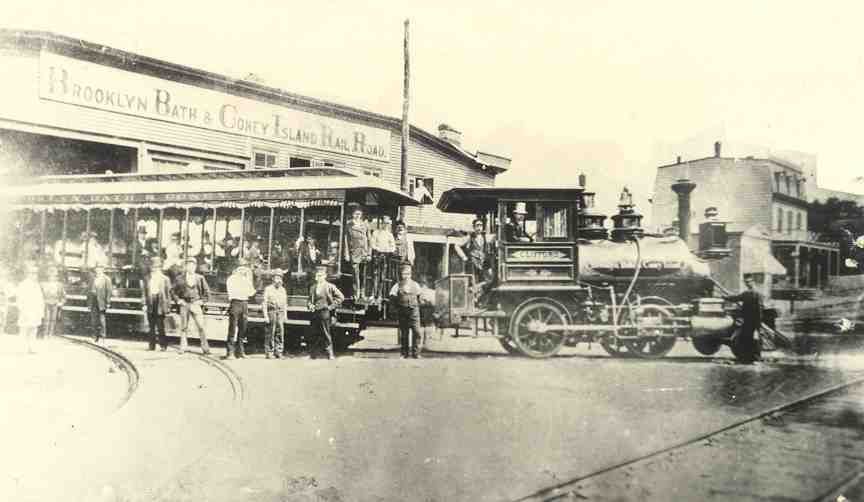
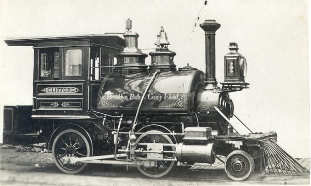
Its origins trace to the Brooklyn and Rockaway Beach Railroad, chartered December 24, 1863 and opened October 21, 1865, from the Long Island Rail Road in East New York to a pier at Canarsie Landing, very close to the current junction of Rockaway Parkway and the Belt Parkway, where ferries continued on to Rockaway.  The Canarsie Railroad was chartered on May 8, 1906 as a BRT subsidiary. The line was partly elevated, and electrified with third rail on the elevated part and trolley wire on the rest, south of New Lots Avenue. The Long Island Rail Road, which had used the line north of New Lots to access their Bay Ridge Branch. The East New York terminus was extended several blocks along a section of line formerly used for "East New York Loop" service to the Fulton Street Elevated and the Broadway Elevated, at a point known as Manhattan Junction or later,Broadway Junction.


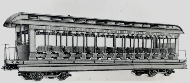
Service, first run on July 28, 1906, ran from Canarsie Landing to the Broadway Ferry at the foot of Broadway in Williamsburg, at the East River. Most of this route is in use today as the Jamaica Line. The route was later extended over the bridge and along the BMT Nassau Street Line to Canal Street and then Chambers Street.


The Dual Contracts subway expansion scheme around World War I saw the rebuilding of the complex train junction at Manhattan Junction into an even more complex flyover junction now known as Broadway Junction. The expansion extended south to the point at which the Canarsie and Fulton Street Elevateds diverged, including a six-track, three-platform station at Atlantic Avenue. The complex was rebuilt under traffic and opened in stages, reaching completion in 1919.


At the same time, the BRT moved to eliminate remaining operations that required elevated trains to operate under overhead wire. In most cases this meant using third rail on fully grade-separated lines. When third rail was extended on the Canarsie Line it was decided to extend this power mode only as far as the important station at Rockaway Parkway and Glenwood Road. Beyond that point, frequent grade crossings made third rail impractical. This portion of the line was converted to the Canarsie Shuttle using elevated cars in 1917 and converted to trolley cars in 1920.


One grade crossing was retained at East 105th Street despite the third rail, and was the last public rapid transit grade crossing in New York City. The crossing was removed in 1973.


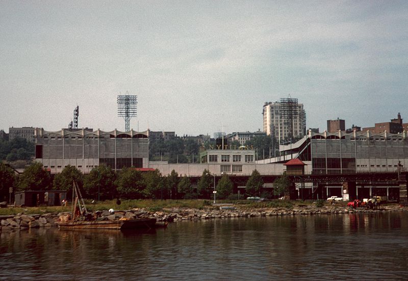
There are many great photos of trains on the complex trackage at East New York where the Jamaica Broadway,Fulton Street and Canarsie lines mixed it up to allow service from the outlying branches to reach downtown Brooklyn and Manhattan by several routes . Adding to the complexity was trackage to access the East New York Shops and yards . The present subway extension from 8th avenue and 14th street through Brooklyns Williamsburg and Bushwick sections reaching the Elevated portion of the line in East New York was completed during the 1920's. Todays scene at these locations is much simpler as only the L service and Jamaica el service remain.


Here are a few photos that show the outer reaches of the Cabarsie line in the glory days. We have atrain set of Multi's , a 5 car articulated train set built in the 1930s and intended for use by the BMT on its older El lines in Brooklyn . New York City had other ideas about Elevated rail lines and the Multis saw service on the Canarsie line as an alternate. This set is arriving on Grade from Manhattan at the Canarsie Rockaway Parkway depot. You can see the Bluebirds in the Canarsie Yard.  


img_75651


  A set of Multis at the Wiiden Platform and in the yard we have the R-11s second Ave Prototype cars along with the Bluebirds. The oddballs were at home on the Canarsie line. 


img_109383


 BMT standards worked this line as well and were original equipment when the subway extension to Manhattan was completed in the 1920s. They were on this line into the 1960s as I recall. This set is getting to make the run to Broadway Junction and on to Manhattan


img_109386


 Here we have a set of Multis getting set to depart for Manhattan . Its the mid 30's and the Multis are almost new here. We have some travelers in their Sunday finest.


img_101410


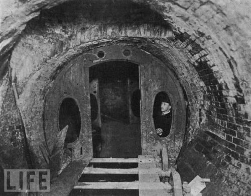
The last Photo is interesting. At the 42nd street station Concourse in Manhattan which connects the BMT 4th ave Broadway subway with the IRT 7thavenue line and the IRT Flushung line, there was a sign " to Canarsie" stuck up on one of the steel girders exposed in the concourse that directed travelers to Canarsie. The Canarsie line did not serve this station so the intent of the sign is curious. I wonder if its still there?


TS-canarsie1-545x380


Attachments

Images (5)
  • img_75651
  • img_109383
  • img_109386
  • img_101410
  • TS-canarsie1-545x380
Last edited by LIRR Steamer

Rails photo shows the Ninth ave el along 110th street in Manhattan where the line turned from Ninth ave to go east to Eighth ave in Manhattan. The Ninth ave El was the original elevated line in Manhattan first operating in 1868. Over the years, the line was extended from South Ferry north through Manhattan to 155th street at the Polo Grounds. It continued accross the Harlem river at this point serving the New York Centrals Sedgewick ave station on the Putnam Division. Traveling eastward, the Ninth ave el joined the Woodlawn Jerome line and trains eventually ran all the way to Woodlawn Rd in the Bronx. The Nonth ave el was closed in June of 1940 . All of it was removed at that time save for the Section that ran from 155th st accross the Harlem River to The Woodlawn Jerome line. This piece was known as the Polo Grounds Shuttle and remained in service until 1958. The location in the photo was colloquially referred to as "Suicide curve."  The station and trackways were at a height of 100 feet and it was reputed to be a favorite spot for jumpers, therefore the Suicide Curve moniker.

Bens photos illustrate the magnanimity of the Grand Central Project. It went on for about 10 years and construction was undertaken while trains continued to operate and use the terminal. When enough of the new depressed station facility was completed, it was put into operation and the construction actibity moved westward on the site. It was indeed a remarkable engineering and construction feat of Modern times. The last photo is interesting as it shows the Park Ave roadways and the bridges used for the crosstown streets .These are still in place today even though the entire terminal area is below ground and covered over.

LeavE it to Ben to come up with the Gems.


lexingtpn


Interesting view of the entrance to the yard. The train is a set of BRT convertible gate cars most likely in service on the Lexington ave El. This would date the photo to 1950 or earlier. The Lexington ave route started at Eastern Parkway and operated on the Jamaica E; to about Gates ave. It tirned of onto its namesake El line down to Grand Street where it tuned onto the Myrtle ave Line to Brifge and Jay street. Before 1944 this train would run over the Brooklyn Bridge to Park Row.


east NY


Thats quite a collection of Equipment in the yard. There are standards, R-10s? , R-16s probably near new here, some more gate cars and the R-11 Ben Mentioned. This is [rpba;y about 1957 and those Gate cars were probaby once at work on the Myrtle Ave line but now replaced by the Q cars.


10420382_969572653057503_3234404328662076584_n


interesting early photo. The Dime savings Bank was yet to rise on the right hand side of the plaza which itself is yet to be completed. Washington Plaza to the right is still waiting the statue of General Washington on his mount'.


1906-Williamsburg-Bridge-Entrance-at-Delancey_Street


Here is the construction photo on the Manhattan side at Delancey Street. I love the horse drawn vehicle on the roadway heading to brooklyn. Weren't many motorized vehicles back about 1906. Construction is underway for the rapid transit facilities. There were two trolley lines and the BRT EL now Jamaica Line. Looks like an El car is in the construction area. When I look at the framework above the construction, i cant help wonder if the BRT originally contemplated an El in Manhattan.


14111062736_f1e3fd94f1_z


This photo shows the Brooklyn side of the Bridge. Both Bridge Plaza and Washington Plaza are complete. The Bridge roadways are operational as well as trolleys of the BRT on the left and the New York railway ( Green Line). This one was closed in the early 1930s . The company was taken over by what became a New York City Icon, The Fifth Ave Coach company. The slogan was " Go the Motor Coach Way". This company itself is long gone from the New York City Transit scene.

Attachments

Images (5)
  • lexingtpn
  • east NY
  • 10420382_969572653057503_3234404328662076584_n
  • 1906-Williamsburg-Bridge-Entrance-at-Delancey_Street
  • 14111062736_f1e3fd94f1_z

A Little Christmas in New York


The R-1 R-9 set was out and about 


nyc-vintage-subway-02


The Tree at Rockefeller Center would be a destination if you are riding the <useum Train


rockefeller-center-christmas-tree-20071


Heres a New York thing!! Bringing the tree home on the Subway


newyorker_christmas_cover


Some Santas on the way in the Subway


456600877-1024x682


Sometimes the Grafitti carried a festive message


Subway_Art_-_Merry_Christmas


And at the end of the day , the Santas arrived Safe and Sound on New York's Subway System


5360fb4258d4878dc0b56803346546da


Wishing all on the Forum a very Merry Christmas and a Happy New Year

Attachments

Images (6)
  • nyc-vintage-subway-02
  • rockefeller-center-christmas-tree-20071
  • newyorker_christmas_cover
  • 456600877-1024x682
  • Subway_Art_-_Merry_Christmas
  • 5360fb4258d4878dc0b56803346546da

Ok Forum Detectives. You haven't cracked the case yet but Ben has given you several clues.

1. Its Bens favorite El line in Brooklyn, close to home.

2. In the pictures posted in the second post, Ben has showed us locations at both the North end and the South end of the area of interest. The photos can also identify the line as well

3. The El in question had center platforms.

4. The locations identified are stops on this El in the area of interest


Can you guess Now? I think I know the locations but lets see if any of the forumites know the locations with all the hints


Hello Ben F  !!


I KNOW that YOU already know the answers - heh - and so do I. 


Those first two photos are of the 5th Avenue EL in Brooklyn.  I have them in my collection and KNOW what the intersections are.


The 3rd photo  is a Turtle Roof 1000 series BMT EL Car at the 36th St Station next to the abandoned former steam-era massive Elevated Yard and its abandoned multi-track elevated structures seen at left --- the car or train is heading outbound to leave the 5th ave EL at the nearby Y junction -  and turn and head east to go over to the Brooklyn 3rd Ave EL...where it turns left - or south,  to eventually go to the 65th St Terminal of that EL, and connect with the BRT Trolley there.


The next (4th) picture is looking inbound from the end of the single center island  platform of the Atlantic Avenue EL Station on the BMT Fifth Ave EL with the train heading inbound toward  where the 5th Ave EL a few blocks away crosses under the higher Fulton St EL (seen in distance) and does the slight S curve there into Hansen Place and eventually merges a couple of blocks further into the Myrtle Ave EL near that EL's Navy St Station.


I already have all these displayed photos in my BMT EL print photos collection for many decades time now.


Happy Holidays !  -  Joe F

Last edited by Joseph Frank
Originally Posted by Joseph Frank:

  !!

Hello Ben F  !!


I KNOW that YOU already know the answers - heh - and so do I. 


Those first two photos are of the 5th Avenue EL in Brooklyn.  I have them in my collection and KNOW what the intersections are.


The 3rd photo  is a Turtle Roof 1000 series BMT EL Car at the 36th St Station next to the abandoned former steam-era massive Elevated Yard and its abandoned multi-track elevated structures seen at left --- the car or train is heading outbound to leave the 5th ave EL at the nearby Y junction -  and east to go over to the Brooklyn 3rd Ave EL...where it turns sound to eventually go to the 65th St Terminal.


The next (4th) picture is looking inbound on the BMT Fifth Ave EL with the train heading inbound toward  where the 5th Ave EL crosses under the higher Fulton St EL (seen in distance) and does the slight S curve there into Hansen Place and eventually merges a couple of blocks further into the Myrtle Ave EL near that El's Navy St Station.

I already have all these displayed photos iun my BMT EL photos collection for many decades time now.


Happy Holidays !  -  Joe F

That's no fair Joe   Would love to see some of those pics from your archives

Fort Lee and Edgewater were very much a part of the New York railroad scene  A little further south of there was the New York Centrals Weehawken terminal.  It was also serviced by NJ Public Service trolleys that had to climb a huge trestle.  I worked in the buildings that were built in the location after the railroads were abandoned  The Hudson Bergen Light rail services the area now over ex Erie trackage


img_116253

img_116256

img_116257

img_116258

img_116259

img_116260

img_116261

img_116262

Attachments

Images (8)
  • img_116253
  • img_116256
  • img_116257
  • img_116258
  • img_116259
  • img_116260
  • img_116261
  • img_116262

Calvin,


The engines in the first photos are officially called the NYC S-1 electric. It still has the original single axle lead and trail trucks.


They found that it didn't track properly and soon substituted 4 wheel trucks on the front and rear. These are the engines that I used to watch in the south Bronx at the Mott Haven yards as a kid.


Lionel made models of two versions of this engine several years ago.


f003

sh002


Jim

Attachments

Images (2)
  • f003
  • sh002
Last edited by Jim Policastro

This photo (circa about 1900) shows the view of Hunter’s Point in Long Island City from Sunnyside, Queens, which is just across from Greenpoint on the north side of the Newtown Creek.

Photo from the book, 300 Years of Long Island City; in memoriam of Vincent Seyfried, prolific historian and author.


cowhunters1

Attachments

Images (1)
  • cowhunters1

Seeing that view of Hunters point from Sunnyside and the cow, recalls the early history of this land as dairy farms , What was not usable was marshland in the same area. At the turn of the century, these lands were largely undeveloped as shown in the photo . The PRR acquired these properties in preparation for the Sunnyside yard project which was a necessary adjunct to the Pennsylvania station project. In short, the land was too expensive in Manhattan for train storage and service and so Sunnyside came to be. The opening of the Quuensboro Bridge accelerated the urbanization of the area and it was just a few years later with the dual contracts that Flushing and Astoria Eles were constructed and placed into operation by the IRT and BMT . Thes companies operated the Elevated lines jointly until 1949. 


We have a few views of the area to relate it to modern times. 


The Track map presented in this image conveys the immenseness of the PRR and LIRR yard projects in Sunnyside and Hunters point as of 1956. 


sunnysideyard1956


These railcars and trains at Sunnyside might be standing here where the cow was grazing in the 1900 photo. 


PC_Sunnyside Yards 1966


LIRR S class Alco was working over near Yard A. The Snshine Biscuits sign and building was a landmark. The building us still there but the sign is not. The LIRR Alcos were originally ordered by the PRR for the LIRR before the PRR placed the LIRR in Bankruptcy in 1949. These locos were delivered in the Brunswick Green with Dulux lettering ala PRR . The LIRR painted the pilots white. They wore these colors for a decade or so before being repainted into Goodfellow colors. 


L448-Sunnyside-LIC-8-13-66


here is an  aerial view of the area . You can see the Flushing Line exiting the Hunters Point Ave station and curving to the top of the photo heading towards Queensboro Plaza. Just East of there, the Montauk LIRR branch curves onto the Main line leading to the Sunnyside yard and to the East on the LIRR

sunnyside-yards


Ok Back on the Ground so to speak, we can see the yards looking east from the Flushing Line just as it turns north.


3090741120_eb4c89c981_z


Still on the Flushing El, not quite one block north of the prior photo with a Nanhattan bound no.7 coming at us. The Tunnels under the east river were originally known as the Steinway tunnels. They were used by the Steinway trolleys before being bought for the IRT service. Low Vs once ran on these tracks into the late 1940s. 


IMG_9455


I think that cow would not recognize the place judging by these photos. Enjoy the visit.

Attachments

Images (6)
  • sunnysideyard1956
  • PC_Sunnyside Yards 1966
  • L448-Sunnyside-LIC-8-13-66
  • sunnyside-yards
  • 3090741120_eb4c89c981_z
  • IMG_9455

Just came across this pic.....not sure it's been here before.....


I think I see:

The EL and ajacent yard by the Polo Grounds.

The New York Central Hudson Division ( and maybe the area of the Putnam Division yard)

The Jerome Ave EL/Subway #4

The New York Central Harlem Division  with what looks like the car yard near Cardinal Hayes HS.


Peter


Last edited by Putnam Division

Hello Peter (Putnam)


Thats a nice photo taken from the Bronx shoreline to the Polo Grounds Stadium.  Also note that it is also showing the ex-IRT 9th Avenue EL remnant "Polo Ground Shuttle" in the foreground....


However - PHOTO DATE OF 1961 IS WRONG -- the shuttle line closed in August 1958 and was removed by mid 1959 on the Manhattan Side. I would date that photo between late 1958 and earlier. I rode that shuttle many times and took photos of and on it about one month after it closed and abandoned- in August 1958. 


Here are a few of the hundred or so photos I have in my Polo Ground Shuttle collection file.


And I am enjoying this long photos thread and the various commentaries !


Regards - Joe F

N to Polo Ground next to ex-9AV EL Shuttle-1956

West at River Ave to E.162St Polo Shuttle-to Anderson STA-1950's

Attachments

Images (2)
  • N to Polo Ground next to ex-9AV EL Shuttle-1956: N to Polo Ground next to ex-9AV EL Shuttle-1956
  • West at River Ave to E.162St Polo Shuttle-to Anderson STA-1950's: West at River Ave to E.162St Polo Shuttle-to Anderson STA-1950's
Last edited by Joseph Frank

Looking at the arial shot of the area here are my comments.

The 9th ave el is up and running. You can see trains south of 155th St. Station. The Green lines yard North of the Macombs Dam Bridge viaduct and West of the el station is intact as the transfer table is visible. The area South of the Polo Grounds showing the diagonal area with no vegetation is the construction remains of the Ind Concourse line The Nassau houseboat that was present at the Bronx shoreline at Putnam bridge is not there yet. Sedgwick Ave. station is still intact with the NYC Putnam portion and the yard along Sedgwick Ave. Also visable. No Major Deegan highway yet. NYC. Highbridge yard has been reduced in size. (That area between the yard leads was where the Composites were stripped of their original trucks and had the Maximum traction tracks install for elevated operation. The Flivvers were also delivered there and had the Composite trucks installed. The yard remained like that for many years after the conversion was completed) The 3rd Ave. Railway yard North of the Bronx side of the Macombs bridge viaduct and West of Ogden Ave. has been removed. The Yankee Stadium is up and so is the Bronx County Courthouse. There are little To no automobiles in the photo. My best guess is the photo was taken in the early Thirties.

Nate


Hello all


As long as we are on the ex-9th Ave EL POLO Grounds Shuttle line and area - here is what I have to offer - in a few sets of Before and After scenes -- including an architect's proposed new development planned to re-claim to entire Shuttle Line R-o-W and real estate Between Anderson Avenue and Jerome Avenue - of which I have photos of.  I will later post photos of the Anderson Avenue side of this proposed complex. 

I have provided LOCATION Captions under each photo.


For those interested in this long abandoned EL line, and who may be personally family-connected to it and the neighborhood as I was in the 1950's thru late 1960's, Enjoy !


Regards - Joe F


01a-N on Jerome Av to Anderson STA-9AV EL-1920's-

ABOVE - 01a-N on Jerome Av to Anderson STA-9AV EL-1920's-


01b-N on Jerome Ave to ex-9AVE EL Anderson STA crossing-2011 [2)

ABOVE - 01b-N on Jerome Ave to ex-9AVE EL Anderson STA crossing-2011


01c-N on Jerome Ave at Ex-IRT Anderson Ave EL STA-2013

ABOVE - 01c-N on Jerome Ave at Ex-IRT Anderson Ave EL STA-2013


02a-N. on Jerome Ave to Anderson AV STA-9AV EL-1902's

ABOVE - 02a-N. on Jerome Ave to Anderson AV STA-9AV EL-1920's


02b-N. at Jerome Ave to site of ex-IRT Anderson STA-2013

ABOVE - 02b-N. at Jerome Ave to site of ex-IRT Anderson STA-2013


03a-W on NB Track to Anderson STA-9AV EL-1939

ABOVE - 03a-W on NB Track to Anderson STA-9AV EL-1939


03b-Proposed redevelopment-Ex-IRT Anderson Av abandoned Station-a

ABOVE - 03b-Proposed redevelopment-West to Ex-IRT Anderson Av abandoned Station

property and location


04a-SW to Wall-end remains-Anderson STA-9AV EL-2004

ABOVE - 04a-SW to Wall-end remains-Anderson STA-9AV EL-2004


04b-S on Jerome Ave At ex-Anderson Ave IRT EL STA-2013

ABOVE - 04b-S on Jerome Ave At ex-Anderson Ave IRT EL STA-2013


04c-Proposed Redevelopment-SW on Jerome Ave to former location Anderson AV STA-

ABOVE - 04c-Proposed Redevelopment-SW on Jerome Ave to former location Anderson AV STATION


05a-Old ex-9AV EL-Polo Grounds Shuttle W.162 St route

ABOVE - 05a-Old ex-9AV EL-Polo Grounds Shuttle W.162 St route


05b-New Yankee Stadium now sits on Polo 9AV EL R-o-W-2012

ABOVE - 05b-New Yankee Stadium now sits on Polo 9AV EL R-o-W-2012


05c-Proposed Redevelopment-aerial showing new one block constr. on ex-IRT Anderson Av Station

ABOVE - 05c-Proposed Redevelopment-aerial showing new  one block constr. on ex-IRT Anderson Av Station


06a-N.E. on Jerome AV to Anderson AV STA-IRT Polo Shuttle-1955

ABOVE - 06a-N.E. on Jerome AV to Anderson AV STA-IRT Polo Shuttle-1955


06b-N.E. on Jerome AV to where IRT Anderson AV STA crossed-2013

ABOVE - 06b-N.E. on Jerome AV to where  IRT Anderson AV STA crossed-2013

Attachments

Images (15)
  • 01a-N on Jerome Av to Anderson STA-9AV EL-1920's-: 01a-N on Jerome Av to Anderson STA-9AV EL-1920's-
  • 01b-N on Jerome Ave to ex-9AVE EL Anderson STA crossing-2011 (2)
  • 01c-N on Jerome Ave at Ex-IRT Anderson Ave EL STA-2013
  • 02a-N. on Jerome Ave to Anderson AV STA-9AV EL-1920's
  • 02b-N. at Jerome Ave to site of ex-IRT Anderson STA-2013
  • 03a-W on NB Track to Anderson STA-9AV EL-1939
  • 03b-Proposed redevelopment-Ex-IRT Anderson Av abandoned Station
  • 04a-SW to Wall-end remains-Anderson STA-9AV EL-2004
  • 04b-S on Jerome Ave At ex-Anderson Ave IRT EL STA-2013
  • 04c-Proposed Redevelopment-SW on Jerome Ave to former location Anderson AV STA-
  • 05a-Old ex-9AV EL-Polo Grounds Shuttle W.162 St route
  • 05b-New Yankee Stadium now sits on Polo 9AV EL R-o-W-2012
  • 05c-Proposed Redevelopment-aerial showing new  one block constr. on ex-IRT Anderson Av Station
  • 06a-N.E. on Jerome AV to Anderson AV STA-IRT Polo Shuttle-1955
  • 06b-N.E. on Jerome AV to where  IRT Anderson AV STA crossed-2013
Last edited by Joseph Frank

The remnants of the el at Yankee stadium makes it  looks like the tracks were part of the stadium.  As joes map shows the route goes right through what is now the stadium   This is River ave where the 9th ave el tracks would be on the lower level and curving toward the river.  This pic was taken before the new stadium was built  Have to get an updated one


6320566990_d43b74b079_z

Attachments

Images (1)
  • 6320566990_d43b74b079_z
Originally Posted by Putnam Division:

Just came across this pic.....not sure it's been here before.....


I think I see:

The EL and ajacent yard by the Polo Grounds.

The New York Central Hudson Division ( and maybe the area of the Putnam Division yard)

The Jerome Ave EL/Subway #4

The New York Central Harlem Division  with what looks like the car yard near Cardinal Hayes HS.


Peter


This picture shows how deep center field was at the polo grounds   Imagine todays primadonna hitters dealing with 455 foot center field wall  It was short down the lines though.   Also the coach yard just to the north of the Polo grounds was huge   The yard was elevated and there was a ramp down to a few tracks beneath it that was used for MOW.  These two pics were borrowed from the ERA book entitled The Elevated Railways of Manhattan


img003

img004

Attachments

Images (2)
  • img003
  • img004

Peter, 

  Great picture! Across the river, there is some sort of housing project that has around 10 or 11 or so towers as part of the structure. Just west of that there is a lower, long building. Could that be The Put's engine house, with the north side showing evidence of sand along the ground where the steam engine's were serviced?

 Tom

Pretty sure that is it. To the west of the engine shed would be the tower. If you have Joe Schiavone's The Last of "The Old Put," on page 6 it shows the track diagram (I think that I gave or sold that to him!) and the picture on page 7 shows the tower and the engine shed. The picture on page 7 also shows a much smaller shed-type of structure just north of the tower and still alongside the shed, which seems to match the aerial photo.

Tom

Last edited by PRR8976

Tom,

As I recall the tower was located on the curve from the structure East of Putnam bridge on the curve into the Putnam right of Way on the North West side of Sedgwick ave station. The steel work remained there until the end of IRT shuttle service. The tower was a brick structure. The engine house was on the West side of the Put's tracks parallel with Sedgwick Ave. It was removed during the construction of the Magor Deegan Highway and the reconfiguration of the Station. I remember riding my bike on the Deegan before it opened. Then riding across Depot Place.(Highbridge Station) , then down the ramp into the vacant lot that was once Highbridge yard. We went South along the shore until we came to the tower which was behind the Nassau house boat. There were pilings that were remains of piers all along the shore and south of Macombs Bridge. At one time that area was a resort area with hotels, boating and fishing as well. Kids would go swimming and dive off the absolute sidof Putnam bridge. Some would get fatally injured  by hitting their heads on the underwater remains. My mother told me never but never  go swimming in the Harlem River. When I saw the sewer pipes spewing out the waste into the water I would not even go near the water for the smell alone. Talk about pollution!

Nate

Tom, Which book of the 3 volumes is related to the Bronx portion of the Put? My interest is in the Manhattan Railway 9th Ave El and the Polo Grounds Shuttle. If you would be so kind to email me the info I can look for the book or books. I will take your advice and stay out of the Harlem River.

Thank You,

Nate

Hi Nate,

 Nate,

   I don't see your email showing. The book that had the engine shed picture and the adjacent wooden tower was the one I mentioned, from Joe Schiavone's The Last of "The Old Put," , which I think was his third book. I probably have his phone number at home if you need it. My email address should show, so feel free to email me.


 Tom

Back on the Polo Grounds Shuttle:


I stumbled onto these three photos on the internet captioned as showing construction on the shuttle route. The first two are on the Sedgwick Ave end of the tunnel and the third is near Anderson Ave. You can see a steam loco on the Putnam line in the background in the second photo


Steam was banned in Manhattan, but was still allowed in the Bronx. It was rare by the time I was old enough to appreciate such things in the early 50s, but I did catch a few glimpses of a passing steam engine.


sed1


sed2


and

Jim

Attachments

Images (3)
  • sed1
  • sed2
  • and

Hello Jim P --


The, your, 3rd last photo is actually LOOKING NORTH on the west sidewalk side of ANDERSON Avenue just below where 162nd Street (over the shuttle tunnel) crosses and dead ends in to.  To the right - where 162nd St ends - see the 2 story building under  construction - as it is to be the NEW headhouse for the Anderson Avenue end of the Anderson - Jerome Avenue joint station.

The head house included offices above and stores and shops on the sides of the dorward for the station entrance.  I know this area and the shuttle very well as my father lived in the block and I rode the shuttle many times.  Here are three images looking EAST on 162nd Street towards the former headhouse of the station and Anderson Avenue crossing left to right.  Also note the 4th image;


E on E.162St-Former 9AV EL-Polo Line Anderson STA-2009

E on 162St to ex-Anderson AV STA-2008

E on 162nd St to Anderson Ave-Anderson ex-Station-2013

N on Anderson AV at !62St-ex-Anderson AV. Station-2014

The ABOVE image is looking NORTH up the hill on Anderson Avenue to the facade of the former station headhouse of the Anderson-Jerome Avenue Station . !62nd St dead ends at the left sid of photo -- and indicated in top 3 photos


Regards - Joe F

Attachments

Images (4)
  • E on E.162St-Former 9AV EL-Polo Line Anderson STA-2009
  • E on 162St to ex-Anderson AV STA-2008
  • E on 162nd St to Anderson Ave-Anderson ex-Station-2013
  • N on Anderson AV at !62St-ex-Anderson AV. Station-2014
Last edited by Joseph Frank

Jims Photos are interesting. Note that in the second Photo with the Sedgewick Ave station under construction, The Tracks from the Putnam line lead onto to the Harlem River Bridge . These trains were still operating into Manhattan at this time into the Ninth Ave El station I guess. 


Rtraincollector has an interesting sequence of photos at Chatam Square on the third ave el. Photos three and four are in the steam days. No signs of any electrification and neither the tracks of the second ave El. The last Photo is from the very early 1950s. WE can see that the South Ferry Branch has been cutback to Chatham Square with Third Ave trains terminating on the upper level. Lower level tracks once used by the second ave El and Third ave locals have been removed. The City Hall Branch is visible as well. Third Ave Trains still in service to City Hall on the lowere level of the station. The trackways for the second ave El are still in place . Looks like the rail was picked up. Second ave trains went to City Hall on the Upper Level here. The photo is almost a decade after Second Ave Service was eliminated. 

Thanks, guys, for the added info on the shuttle area photos.


From my days in the mid 1950s playing ball in the area, I've always been fascinated by the sight of trains seeming to disappear "into the buildings" above them.


I did a little exploring in the area on the Anderson Ave side in the early 1960s after it closed down. I was never brave enough to venture into the tunnel though.


The entire Highbridge area was great for train watching with the two New York Central divisions as well as the shuttle. It was never more than a few minutes between trains passing through.


It was matched only by our favorite spot off Morris Ave on the access road to the commissary on the east side of the Mott Haven Coach yard. That area had yard switching with S motors as well as the New York Central and New Haven lines headed to and from Grand Central.


Jim


Great photos Ben. Very interesting historical perspective. 


Thinking the first Photo is where the 5th ave El joined the Myrtle ave El on its way to Saqnd street and Park Row in Manhattan. 


The second Photo shows the former station at Atlantic on the Fifth ave El. The LIRR Flatbush Ave. Terminal is to the right. Its after 1940 and the Fifth Ave El is being removed including this station. The LIRR station in the photo is now gone, replaced by a new Building and a shopping Mall. WE are standing about where the Barclays center is , Home of the Brooklyn Nets. 


The Third Photo is on the SeaBeach line. Its an early construction photo. and is where the seabeack crosses over the LIRR Bay Ridge Branch. I love that construction equipment in the photo, Steam Powered of course .


The Fourth Photo brings us back to the Fifth Ave El at a point where it leaves Flatbush Ave to Run South on Fifth Ave. I think the street feeding into Flatbush Ave which forms the triangle that the building sits on is Dean Street. This photo looks like its from Near the turn of the century.


The Last Photo is the Culver Terminal in Coney Island. This is where oen arrived to spend a day at the shore in Coney Island Hey day when it was New York's Resort by the sea. 

Here's the pic again:


Tom.....I have volume III of the Schiavone books....I am open to pages 6&7.


I see the engine shed.....it's right where you said.....and the small structure between the shed and the river is High Bridge signal tower B on the Hudson Division.....


What a great picture!


For those of you who have any interest in the Putnam Division....I highly recommend the Schiavone books!


Peter


Peter,

  I know I mentioned this elsewhere, probably not on this thread, but the first Schiavone book, The Old Put, came with a DVD entitled, Walk the Put. On the DVD, Joe did a great job explaining/visiting the station stops and giving some history of them from Van Cortland north to Put Junction. Brian Vangor did the great video work involved. Our friend Skip Natoli appears, too. If you don't already have it, I think you would enjoy it-- if you can find it. I appear in a few of the Yonkers station areas talking about their history...in spite of my appearing, you might still enjoy it!


  Tom


Originally Posted by bluelinec4:

This is the NY Westchester and Boston at Allerton Ave


Wow, my family built a house that I lived in the late 80's not far from where this was shot and it is amazing to see how unbuilt up the area was (I presume this was the 20's). There is a big public school to the right of the tracks on the other side of Allerton Ave (this was shot likely on Throop Ave), and there are all houses and such where this is. 

Ben..........when the New York Westchester & Boston crossed Allerton Avenue  it was already buried in the ground.....west of Gun Hill Rd.....at the Esplanade.


I believe this this is east of Baychester Avenue and the RR goes over the Boston Post Rd. The overpass is still in use today by the Dyre Ave subway.


Peter

Last edited by Putnam Division

@putnam-

Yep, that is what you are mixing up (doesn't help Gun Hill Road makes kind of a wide curve on its route, and ends up crossing the route at least twice (up near Dyre Ave, and I believe further down it does as well).


The old NYWB (now the #5 Dyre Avenue line) is above ground from 180th street, then after Morris Park, goes underground at Esplanade (which is where Pelham Parkway meets Laconia Ave). After the Esplanade stop it comes out of the ground pretty quickly to being elevated and crosses Allerton Ave elevated where Allerton and Throop Ave cross. 


I lived in that area for a while in the late 80's-early 90's, and I commuted on the 5 train from the Esplanade stop, so I know it pretty well (not to mention I was working nights the first couple of years, so was coming home at 2am

Tom........you are so right....NYW&B!


big kid......that's what I did........I need to go back and ride the route again.......and drive down Allerton from Gun Hill Rd to White Plains Rd......and get the feel for the topography again.....

While I'm at White Plains Rd, I will take a peek under the EL....and see who is occupying the storefront where Honig's Pkwy, the train store I used to frequent as a kid, was.


Peter

Last edited by Putnam Division

Very interesting info regarding Madison hardware. I went there as a young boy and looked up at the Lionel Madison set on display above. All I could do I stare at it. No $. One day I found a Lionel Hell Gate Bridge in the garbage room. I took it to my apartment. When my mother came home and saw it and I told her where I got it  she told me to get rid of it and told me not to take people's trash. If only she was alive today and could check out EBay. Well I took it on the subway downtown to Madison Hardware. I explained my situation to one of the two old men.  and asked if they would trade me for anything. They asked me what I wanted and I looked up at the Madison cars. After the good laugh he offered me an RM PCC kit which was defective. As I could not take the bridge home I accepted it. I got screwed. Why would a Bronx boy get excited over a PCC anyway?

Another hobby shop I remember was my first. It was called the Friendy Shop. It was located on 167th Street just south of River Avenue at the foot of the Northwest staircase to the Jerme line (4 line today). They did not have many trains but all kinds of neat things including scratch building material. On day they moved to Jerome Ave south of 170th Street. It was next door to Aragoni's bus depot which later evolved into New York Bus Service. After a while the hobby shop went out of business. 

As I got older I found Ma Webster's Model Railroad Supply Co. On 45th  street in Manhattan, but that is another interesting story. I am sure there are many people out there that remember  Ma Webster.


Originally Posted by Nate:
.... they moved to Jerome Ave south of 170th Street. It was next door to Aragoni's bus depot which later evolved into New York Bus Service. After a while the hobby shop went out of business. 


Nate,


That shop is where I got my first HO train set...a Penn Line Midget diesel switcher and a few cars.


There was also The Bronx Hobby Center on the east side of Jerome almost directly across from the bus depot. They had mostly HO as well as the usual hobby shop supplies. I began scratchbuilding in the early 1960s as a teenager and they were my source of supplies.


I too began heading down to Webster's Model RR Equipment Corp. very frequently as soon as I could ride the subways by myself.


Since those were my HO years, I can imagine what neat Lionel items I missed out on. I didn't return to 3-rail until the early 1980s. 


Another shop I've never heard much about was located on Fordham Rd just east of 3rd Avenue across the street from Fordham University. I credit them (or is it blame them ) for getting me to switch from Lionel to HO. They had an in-store layout, and there was something about those shiny brass rails and neat little trains that drew me in.


Jim

Last edited by Jim Policastro

When my wife and I went down to the Grand Concourse get our marriage license in 1985, we stumbled upon a variety store which had an extensive train department. Much of the stock was very expensive European equipment. The store was right on the Concourse and, for the life of me, I can't remember the name of it. I was shocked to find a store with such an extensive selection of equipment in that neighborhood by that late date. I meant to go back but never did.


Bob

Originally Posted by Putnam Division:

Tom........you are so right....NYW&B!


big kid......that's what I did........I need to go back and ride the route again.......and drive down Allerton from Gun Hill Rd to White Plains Rd......and get the feel for the topography again.....

While I'm at White Plains Rd, I will take a peak under the EL....and see who is occupying the storefront where Honig's Pkwy, the train store I used to frequent as a kid, was.


Peter

If you mean White Plains and Allerton under the 2 train, it is mostly bodegas, spanish restaurants and a couple of dollar store like things, the only good news is very few empty stores, but most of them are typical inner city kinds of stores with a bank or two. 


The only other hobby store I remember was a place over on Broadway in Riverdale, Brown's Hobby or Brown's hardware (I don't recall)....

Originally Posted by bigkid:
The only other hobby store I remember was a place over on Broadway in Riverdale, Brown's Hobby or Brown's hardware (I don't recall)....

I think the place you're talking about was a block or two north of the 242nd Street terminal. When I started dating my wife in '83, she lived on 238th Street. There was still an advertisement for the hobby store on the side of the building but it was long gone by that time.


Bob   

Originally Posted by CNJ 3676:
Originally Posted by bigkid:
The only other hobby store I remember was a place over on Broadway in Riverdale, Brown's Hobby or Brown's hardware (I don't recall)....

I think the place you're talking about was a block or two north of the 242nd Street terminal. When I started dating my wife in '83, she lived on 238th Street. There was still an advertisement for the hobby store on the side of the building but it was long gone by that time.


Bob   


Brown's Hobby Center is the name I recall, a block or two North of the 242nd St. IRT station.  I got a lot of model plane stuff there in the fifties.  Dad and I used to take the Broadway Local (now the 1 train) from 157th street (four blocks from where we lived) but don't remember seeing much of model trains there.  A lot of model plane guys flew in the huge meadow at Van Cortlandt park across the street from Brown's.


Pete


Speaking of the NYW&B.....in the South Bronx the line parallels the New Haven. Here are some pics of the Westchester Avenue station. Both the NH and the NYW&B shared this station (the NH ran passenger service on the river line until the early 30s).


This station can be seen from the Sheridan Expy and from Amtrak.....but you have to look quick. It is in danger of disintegration if something isn't done for it soon.


thumbs_36-rr_-station

thumbs_37-rr_-station

thumbs_38-rr_-station

thumbs_33-subway-trestle


Peter

Attachments

Images (4)
  • thumbs_36-rr_-station
  • thumbs_37-rr_-station
  • thumbs_38-rr_-station
  • thumbs_33-subway-trestle

Jim,

There  was a great pickle store on the east side of Jerome Ave. south of  170th  St. Do you remember it?

I would sit by my bedroom window and work on my trains On the sill. While doing that I would watch the trains go by. I could see the el from Yankee Stadium up till the south end of 167th St. station with the exception of the Polo Grounds Shuttle there wer LO-V's running 24 hours a day. Occasionally a work train came by. In 1957 when the ramp opened into Concourse yard all that changed. Everything went by. My window then. I was able to tell the type of cars by sound while laying in bed. On fond memory was in January or February when it was real cold they would send a full train of cars with flat wheels to Concourse barn to the wheel trying machine. This was usually done about 3:00 AM. The noise was so loud as the steel was so cold that the glass in the windows would rattle. It woke up everyone in the apartment houses.  Then the shuttle would make it up the ramp and find the signal Red because the tower man was asleep and the switch was set for Jerome trains. Then the Motorman started blowing his whistle. He would wake up everyone in that area except the  Towerman. If I needed supplies I would go downstairs get on the train, go down  to 42nd St. Walk up to 45 th St. Get my stuff and get back home and be sitting back at my window in about 25 Minutes. I used my school train pass so the trips were free

That all ended when I left for the Air Force in 1959. When I returned nothing was ever the same again.

Also some of the guy have mentioned Hoenigs. (Hope I spelled it correctly)I recall that there was a company with that name that supplied delivery bikes to stores all over the Bronx. The were tricycles with a large basket in front. I worked for a fruit store on River Ave. & McClellan St. It was horrible trying to get up the hills with a load. The worst was delivering an order on Shakespere Ave. Hoenigs main building was located on Park Ave on the bridge over the Railroad on the west side around 170th St. If I am not mistaken.

Hope I did not bore you guys,

Nate


Nate,


I'm not sure about that pickle store, but we did practically all our shopping in the 170th St area. We lived on College Ave between 169th and 170th. The deli just below Elsmere Hall had a great pickle vat too!


Even though we were closer to the Concourse D train, we'd take the Jerome El just to ride the Lo-Vs with their neat vestibules. I wished I lived closer to the El, but had a friend who lived on 3rd Ave at Claremont Parkway. I'd watch and listen to the 3rd Ave El all night when I stayed over.


Played ball in the fields just below the Polo Grounds shuttle, walked to Yankee Stadium, and had the New Haven and NYC electrics to watch along Park Ave and at Mott Haven.


It was a great area of the Bronx to grow up in.


Jim

Thanks to all who contributed to this posting....   I just bumped into it....  Brought back an awful lot of memories.   My dad who passed away last summer, always used to tell me about the Polo Grounds and the center field that never ended...  I never got to actually see it, I was born the year it was being torn down.  His parent's last apartment was up o the Concourse about 3 to 4 blocks from the old Yankee Stadium.  Needless to say my dad was an unbelievable baseball guy who took me in to the Bronx every weekend to play ball up at Van Cortland Park and he started taking me to Yankee stadium probably around 1962, 1963...   Anyway, it was great to read through this posting and see all great old photos.    I love the forum, thanks to all for sharing.   

Tom,

It was very easy to walk to and fro between the two ballparks. When  the stadium was crowded and the parking lots were full at the Yankee stadium you would be able to park at the Polo Grounds parking lot and walk over to Yankee Stadium. If you wanted to you could take the Polo Grounds shuttle to 167th St. Go downstairs to the downtown side and take a Jerome line to 161st. St. Then on your way out pick up a free transfer to the IND subway and when the game was over use the transfer to go to 155th St. Station and get off at the parking lot at the Polo Grounds and get your car.

Nate

As kids we had a lot of freedom, but we were discouraged from walking into that part of Manhattan on our own to get to a ball game.  Plus, it was a chance to ride the shuttle or the subway to the Polo Grounds.


Toward the end, the shuttle became a little confusing as they went to one train operation, and it would sometimes pick up on the northbound side at 167th instead of the southbound platform as before. Even the guy in the token booth had no idea sometimes. Some days we'd give up and take the IRT the one stop to 161st and transfer to the D to get to 155th.


We were a National League family so my father always preferred a trip to the Polo Grounds over one to the Stadium. OK, I'll admit - we were Dodger fans despite living about 10 blocks from the Stadium....made for a tough childhood in many ways (except for that one day in 1955!!!).


But, I did get to see some Giant - Dodger games in the Polo Grounds during the mid 1950s....an experience I wouldn't trade for anything. It was an amazing rivalry with some incredible fans on both sides.


It was only after they deserted the city in '58 that we became regulars at the Stadium by default.


But, speaking of hobby shops, once I became "mobile on my own" by way of subways, it wasn't worth walking or taking buses around the Bronx for train supplies when a 30 min. subway ride would get me down to the Model RR Equipment Corp. on W 45th where they had it all.


Jim


Peter found this great picture of the CNJ Freight House. I was wondering about that Ruppert sign in the left of the picture, which I then figured out had to do with Ruppert Beer, another beer once manufactured here which has since disappeared from the New York City. I found this on Wikipedia:


 Haffen Brewery, later J&M Haffen Brewing Company, and incorporaterd as Haffen Brewing Company in 1900,[1] operated in Bronx, New York from 1856 until 1917. Owned by Matthias Haffen, (1814 - 1891),[1] who came to the United States From Bavaria in 1831, it was a "landmark" on old Melrose Avenue between 151st Street and 152nd Street.[2][3] The Haffen Building, a seven-story Beaux-Arts architecture style office building by architect Michael J. Garvin was built for him in 1901 to 1902.

The brewery business was sold to Jacob Ruppert, Sr. (1842–1915) in 1914 for $700,000. Ruppert died soon after and left the business to Jacob Ruppert, Jr. The plan was to close the brewery down and develop the property; it was in a rapidly growing area known as The Hub, Bronx.


There is another picture that shows a slightly different angle of the freight house and brewery.


Then as a  bonus, if you are interested in some other breweries I found this: http://munchies.vice.com/artic...-new-yorks-breweries

Tom


Attachments

Images (2)
  • Better CNJ crrnjbxt
  • Ruppert crrnjbxtphoto1

Add Reply

Post

OGR Publishing, Inc., 1310 Eastside Centre Ct, Suite 6, Mountain Home, AR 72653
800-980-OGRR (6477)
www.ogaugerr.com

×
×
×
×
Link copied to your clipboard.
×
×