What places does everyone like to use as an example to model an urban siding or spur? Please share your scenes on your layout or scenes from real life!

I decided to model an urban spur/siding in the last corner of my layout that was undeveloped.

I don't have many spots like this near me to go see and I don't have any books on this kind of scene. The closest to me would be Sharon, Pennsylvania or Southern Blvd in Youngstown, OH but it doesn't show much these days. I have to assume the businesses along the tracks at each spot used to ship everything by rail and would have had some means to load things up. I don't know much about this part of railroading. I've spent most of my time studying the steel industry side so this is new territory. I'm going to look up pictures of freight depots in town here when the museums open back up (they close for January to swap exhibits and do whatever museums do behind closed doors).

Original Post

Replies sorted oldest to newest

A lot of stuff in cities is gone. Chicago, Milwaukee, Los Angeles used to be full of all kinds of tight cornered local trackage.  Theres probably lots of books on the old trackage of all 3 of those and more.  For example, google the Milwaukee Beer Line.  A Kalmbach book on Modeling Cities and Towns recently came out and has some chapters on stuff like that.

Some of this stuff does still go on, here's a great example:


BNSF runs a local or 2 south of LAX around El Segundo, and I think UP runs one in Torrance that also are probably worth exploring on a map.

Last edited by Boilermaker1

When I was young, and growing up in Hoboken, the railroads ( Erie, Lackawanna, Hoboken Shore), all served various industries. Hostess received boxcars of bagged coconut for various cakes, Maxwell House coffee was shipped in boxcars, and right next door to that was American Can, which made tin cans, not only for Maxwell House, but other companies. There was also Lipton Tea, various river piers, and coal companies. Even when I moved to PA in 1995, the Lackawaxen & Stourbridge (which was once a branch line of the Erie Lackawanna) served a lumber company, a local coal distributor, a company that turned out raw bats that would be shipped to Louisville Slugger to be finished into baseball bats, and I don’t know what else. Dairies also received raw milk in cans or tanks in box cars and reefers.

@BillYo414 posted:

Would the Capitol Limited work? I'll follow the tracks on Google Maps.

Bill,

Living in the Detroit area, with so much of it's old manufacturing infrastructure demolished, the industrial archaeology has been tough but satisfying.

I have several favorite sources for leads:

  1. Yes indeed start with Google Maps.  In spite of being so new it has surprisingly good coverage of old rail lines; not necessarily industrial spurs but you can easily follow what is there by car and look for the hints that are likely buried under vegetation, here-and-there renovation or removal of trackside buildings, or larger urban renewal projects.
  2. Look for old maps at train shows or the big auction site.  You'll have to purchase these but they're a good investment.
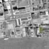
  3. Use online photos when you can find them.  A good example for us here in Detroit are those now held by Wayne State University locally, and originally generated by Detroit Edison back in the day.  DE started photographing SE Michigan after WWII when surplus hi-res camera equipment became available after the war.  There are numerous sets taken at five-year intervals afterward.  They used them for tracking power feeds and planning future power lines but they clearly also show spurs, from directly above (see example below).  A trip to specific locations you spot by studying them is then confirmed with a boots-on-the-ground visit.


Detroit Riverfront, 1961 #1, 2022-01-18 16-32-54

(Above photos courtesy Wayne State University, Digital Publishing Unit.  See https://digital.library.wayne....te_aerial/index.html.  High-Res versions available online as well.)

Mike

Attachments

Images (2)
  • mceclip1: Riverfront, Grand Trunk Depot, City of Detroit, 1961 (Detroit Edison, Wayne State Univ)
  • Detroit Riverfront, 1961 #1, 2022-01-18 16-32-54: Riverfront, Foot of Woodward Ave., City of Detroit, 1961 (Detroit Edison. Wayne State Univ)
Last edited by Mellow Hudson Mike

A very interesting topic.  I wish I had some personal layout photos to share, but I only have real world thoughts from the trains I've been on, or the places I've lived.

Take a ride on the NEC between Philly and NYC and you will see all kinds of settings for this type of track, especially between Philly and Trenton.  The outside tracks there typically do not see passenger service and serve all kinds of industries, large and small and some that simply veer off on a sharp curve through a fence with gates into a dense grove of trees to locations unknown. 

Another example from my college days is the Monon line that ran right through West Lafayette, Indiana.  While maybe not a spur, it ran on the street through downtown well into the Amtrak era before trains were rerouted around town by CSX.

Here in the Phoenix area, we do not have truly "urban" track, but we do have lots of spurs that serve single level warehouse districts, cement plants, and some flour mills.  One of the most interesting spurs is the single track two blocks west of the state capital that connects the former ATSF yard that terminates west of Phoenix running N-S to the former SP yard that is south of Phoenix and runs E-W.  It has a pretty sharp curve as it is in the heart of the urban grid.  This track served to transfer freight cars between the two roads and also was used by ATSF passenger trains #42 / #47 to Phoenix Union Station that is south of downtown until the train was discontinued in 1969.  Even in 1950 that train was only 5 cars long with a baggage, coach, lounge, and two sleepers.  By 1969 it was only a heavyweight baggage and a streamlined coach.  Just an idea for a space limited layout that is based on a prototype.

I think what makes urban track really interesting is how bad it is.  If there was ever an excuse for bad track work, this is it.  With the slow speeds of operations and sharp turns there wasn't much need for great track work.  The other interesting aspect for me in modeling is placing large structures next to urban sidings to give a real sense of scale to the trains.  When we can make our O scale trains look small by comparison, that is interesting to me as they look bigger out on the open track.


. .

BNSF runs a local or 2 south of LAX around El Segundo, and I think UP runs one in Torrance that also are probably worth exploring on a map.

Before I begin, check out https://historicaerials.com/  which is a great site for research purposes. You can purchase prints of various coverages for more detail. It also includes Topographical imagery which roughly shows the track layouts.

The BNSF local comes out of the Watson Yard in Wilmington and serves a couple of industries (Dow Chemical for one). It was cut back substantially to be replaced by the LA Metro Expo Line extension to LAX.

The UP Torrance Branch (former SP Torrance branch/former PE Torrance/San Pedro branch) originates out of a small yard in Downtown Los Angeles and heads through part of the old LA-Long Beach PE line into Gardena (serves several industries along the line including a lumber yard on Western and 166th street (the old PE line to Redondo Beach). Further south (RR west) there are industries along and off Normandie Avenue, then it swings toward Torrance and the old PE Torrance Depot (now a restaurant) beneath the Torrance PE bridge. There was a southward curve that switched onto a line across the bridge to a steel plant (now gone). Further along the line it turns down Sartori to a couple of warehouses next to where the PE Torrance Shops were located. If you had the massive real estate available, it would make for an interesting switching layout. The City of Torrance recently put out an RFP to structurally restore the bridge (it's in the city logo). The work turned out great. By the way, I have the RFP which includes the drawings and dimensions on the bridge. I'd love to integrate it into a layout since there were tracks ON it that connected to tracks going UNDER it. A figure-8 would be simple but incredibly large.

Add Reply

Post

OGR Publishing, Inc., 1310 Eastside Centre Ct, Suite 6, Mountain Home, AR 72653
800-980-OGRR (6477)
www.ogaugerr.com

×
×
×
×
Link copied to your clipboard.
×
×